Day 54 – IAT Mile 1091.2 to 1114.3

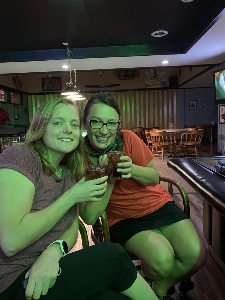
Last night was a blast!  Trisha and Zach took us out to a local restaurant for a traditional Wisconsin Friday fish fry and old fashioned dinner.  After dinner came the Colorado tradition of bar hopping around for shots and drinks, but I was far too tired for any of that and retreated back to our basement bed at Trisha’s for sleep.

Uncle Tim wanted to let Brianna sleep in and experience trail support for himself, so he and I hopped in the car around 0630 and headed for the trail.  It took a bit to figure out the logistics of how Tim would know where to meet me on the trail, he has a different cellular carrier and and Android with different apps than I’m used to.  It all eventually worked out and I was able to start hiking by 0800.

Tim got the chance to experience many different kinds of IAT parking lots while he waited on me to arrive.  My trail walk into Kewuanee ended on a quaint water town with a beautiful bay view.  From Kewaunee, I started the final final road walking miles of the IAT.  Tim met me about 3 miles in at a gravel parking lot, surrounded by weeds with no shade to be found before I started a 8.8 mile push into Algoma.  Hiking 8.8 road miles without a break is not something I’d normally do, but the roads were quiet and enjoyable; the walk took me less than 3 hours.

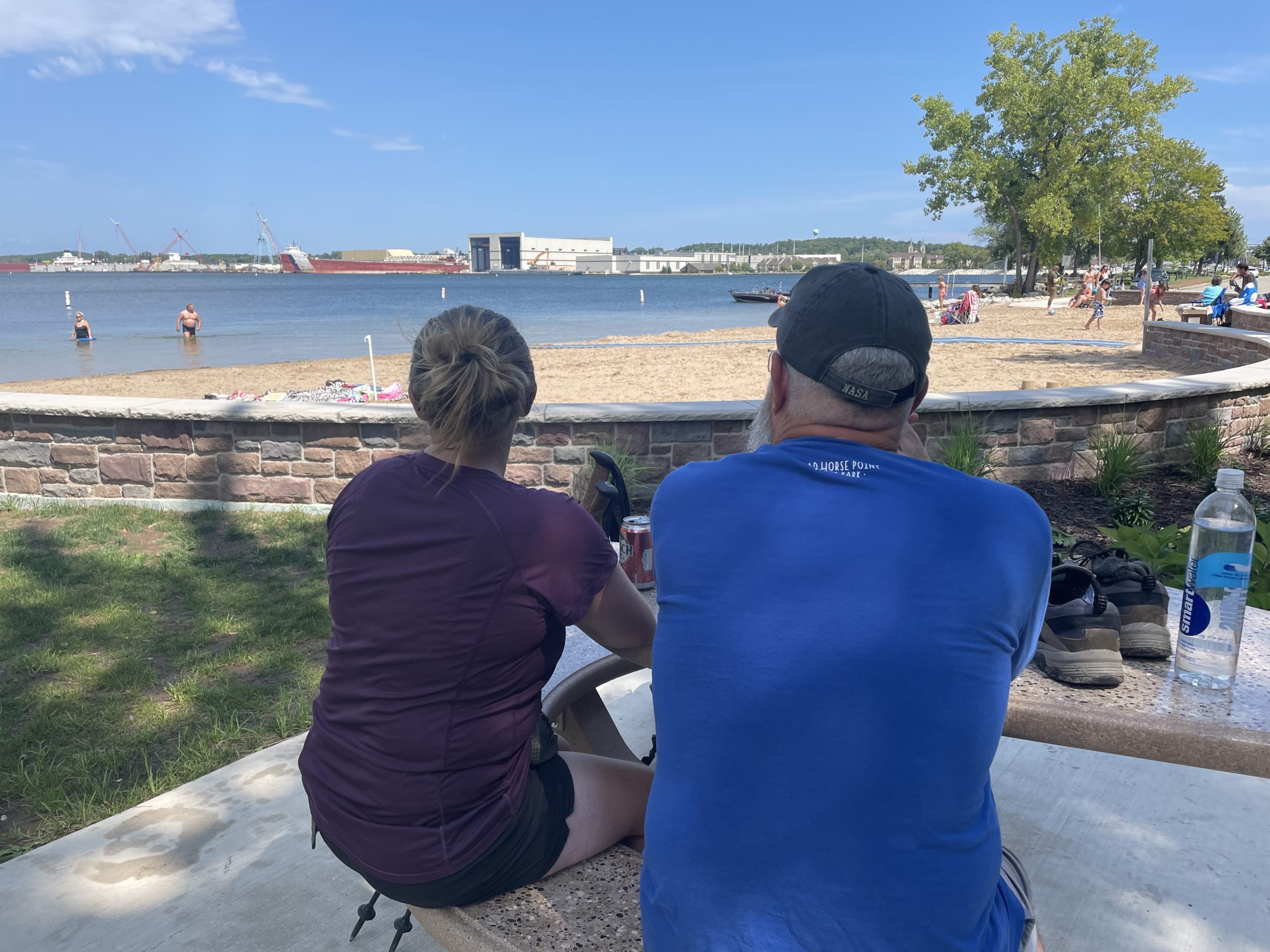
Algoma is another beautiful bit of this eastern IAT section.  The trail took me down a boardwalk over the sand and not far from the water.  I walked and watched Wisconsinites play beach games for about a mile. Tim walked the final stretch of the boardwalk with me before our lunch at a local bar.  We enjoyed cold beer and the second half of the Packers game. 

Finishing the final road miles of the IAT feels significant.  Should I have cried?  Half of me wanted to punch a fist in the air as if it were the end of The Breakfast Club movie while the other half of me wanted to look down at the paved ground and say, “you’re basic.”

A funny thing happened on my second to last meet up with Tim this afternoon.  It was lightly raining when I arrived at our designated spot, I saw our car, but Tim was nowhere to be found.  I didn’t start to get worried until 15 minutes had passed and he was still nowhere to be found, not answering texts or phone calls.  Unsure what to do, I picked my gear up off the wet ground and continued hiking.  He didn’t pass me on my way in, so the only reasonable conclusion was that Tim meant to hike in to meet me, he just didn’t choose the correct direction to do so.  My conclusion was confirmed when a dude on a dirt bike road by me and said there was in fact a Santa Claus beard looking guy down the trail.  I was 1.1 miles in before crossing Tim’s path, he going back to the car, me continuing the hike.

Our hiking day ended as many good days often do, with cold celebratory beers in hand.  We sat on large white parking lot rocks at the Forestville Dam County Park and chatted about life before the hour ride back to Green Bay.

Trisha and family have been beyond accommodating to us over these final days of our trip.  We have access to showers, laundry, a cool basement bed, food, beer, the works.  I didn’t know how things could get better, until they did, and the girls invited Tim and I to stop by a neighbor’s pool party for a BBQ dinner.  The hostess, Jen, brought me as much food as I could eat and then some.  As a marathon runner herself, Jen understood what I was feeling on an athletic level at day’s end.  Dipping my feet in a salt water pool while stuffing my face full of pasta salad was fabulous.

17.8 miles remain.
Day 55 – IAT Mile 1114.3 to 1132.1

IAT completed.

Everyone has been asking if I am/was excited for today.  There are a lot of feelings, to include excitement, for sure, it’s just so very complicated.  It feels good to have finished this hike across Wisconsin and to have done the things we have done.  More than anything, I feel relieved that I’m through the gauntlet.  My body could hike more, but I don’t want to, not in the way we have been these past few weeks.

With the help of Uncle Tim and Aunt Susan, today worked out perfectly.  Brianna hopped on the trail with me in the morning for the final 17.8 miles of hiking while Tim volunteered to run support and meet us throughout the day.  Brianna was feeling good enough to get her feet dirty again!

The trail day started with more dirt 2-track as we finished the final miles that Ice Age Trail shares with the multipurpose hike/bike/horse Ahnapee State Trail.  With beautiful weather and plenty of time to kill between meet-ups, uncle Tim hiked in with us for 2 miles before turning around and heading back to the car for our next scheduled rendezvous.  Having time on the trail with family and friends has been priceless, a rare opportunity to share our passion with the ones we love.  It’s also a lot of fun to give them a firsthand perspective of all the beautiful and tragic parts of life on the trail.

Tim has been so impressed with our journey that he made a point to stop and tell as many people as he can about it.  He interrupted a couple of lady bikers in mid-conservation to tell them our story, both of which responded positively and had many questions for us.  At another point in the day, he had a park full of people clapping for us as we walked into town for our planned lunch.  As a mostly stoic person, it’s often difficult for me to convey emotions –  Tim had no problem getting smiles and laughs out of me with his social graces.

We had hoped to see more hikers over these last 50 miles or so of trail.  It was the weekend with beautiful weather and the trails go through populated areas with beaches and waterfronts galore.  We saw a lot of people on beaches and at parks.  We did not see a single day hiker, section hiker or thru-hiker.  The eastern terminus is tucked away on a peninsula and far away from the rest of the trail, so I get it, I guess.  It boggles my mind that we ran into more hikers on the remote western section than the populated eastern that runs through and around large cities like Janesville and Madison.

Our lunch at the beachy Otumba Park left us with about 4.5 miles left of trail before the eastern terminus.  Aunt Susan agreed to drive our car up to the end point so that Tim could hike the final miles with Brianna & I.  Tim got a solid mix of sidewalks and dirt trails for his final experience, even some hills and stone stairs next to the bay water!  What a beautiful trail to end the adventure on, what a good group to finish the adventure with.

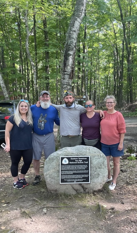
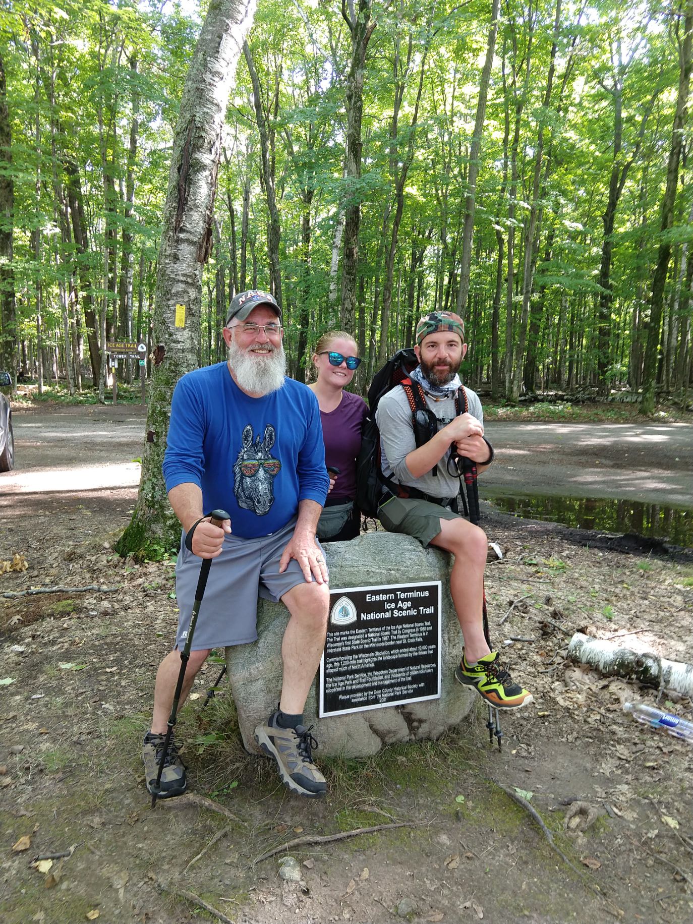
Susan and Trisha were at the end ringing little horse bells and yelling congratulations as we arrived.  I’d be lying if I said I didn’t tear up a bit when we walked up to the final rock.  Sitting on top of the rock next with the eastern terminus sign did feel great, especially after I cracked the celebratory beer.  To accomplish what less than 200 people have done before me is humbling.  To have the support we did throughout this adventure, from both old and new friends, is humbling.  I am humbled.

Lessons learned:  

If I was to do this all over again, I’d take 10-12 weeks rather than the 8 weeks I just completed it in.  2-4 more weeks would have allowed me to take more planned days off in beautiful areas and given more buffer room for unplanned days off when storms or other unpredictable events occur.

I would look to average 12-20 mile days when possible.  Hiking 25-30 mile days is fun and sometimes necessary, depending on allowed camping areas and other variables, but should be kept to a minimum.

Wisconsin is a great state and more like Michigan than it’s not.

Thank you for coming on this adventure with me!  Until next time… 🙂

IAT Thru-Hike Certification Essay

My dream of completing an IAT thru-hike did not start when I was a child.  I did not grow up with a dream of hiking from the western side of Wisconsin over to the east side.  In all honesty, I did not even know the IAT existed until December of 2020 found me searching the Guthook app for trails that might be done in 2 months or less.  2 months was the maximum amount of time I could take off from work and still have a job upon my return.

It did not take much planning time to see that the IAT would be a logistically tricky beast to tame.  I made use of every IAT resource I could find, and there are a lot of them: IAT atlas, IAT guidebook, IAT interactive resource map/website, Thousand-Miler-WannaBe FaceBook group, camping/mileage spreadsheets, books written by previous thru-hikers.  As with most hiking trips, planning for the IAT was more about understanding where to find information and help than it was about making an itinerary.  

IAT Step 1: Create a plan.

IAT Step 2: Get punched in the face.

IAT Step 3: Find a new plan.

IAT Step 4: Repeat.

My favorite memories of the IAT are of the people we met along the way, the random acts of kindness that could not be planned for.   Strangers swooped in and turned terrible days into wonderful nights.  Some of our trail angels were official IAT coordinators while others had never heard of the IAT and were just happy to help people in need.  Trail angels gave us shelter during storms, rides into town, food and water, one even opened up her wellness center business to my wife when she hurt her back and had to jump off the trail.

Thoughts for future IAT hikers:

Take your time.  If I could do it all over again, I would take 12 weeks instead of 8.

Do not underestimate the IAT.  The trail miles are challenging and the road miles are grueling.

Reach out to the IAT community early and often.  The trail coordinators we met were happy to receive updates on their trail segments and hear from the hikers traveling on them. The people are amazing and the land is beautiful.

Certification of Thousand-Miler Status

Hi Martin,

Congratulations on your feat of hiking the entire Ice Age Trail! And thank you for sending in your “Thousand-Miler” application. The information you’ve included is helpful to our efforts to track long-distance hiking stats for the Ice Age Trail.

You are currently in the #289 position in our database out of 289 total certified Thousand-Miler treks. Our first Thousand-Miler finished on July 29, 1979. It took 35 years to reach our first 100 Thousand-Milers; in the past 7 years, an additional 189 have joined the ranks.

We typically honor our Thousand-Milers each April at our Annual Conference and again in the issue of our newsletter Mammoth Tales that follows the conference. We will be sending your Thousand-Miler certificate and patch to you by mail in the coming weeks, and have added you to the listing of Thousand-Milers on our website

Again, congratulations on your remarkable feat.

Welcome to Our Adventures!

You have wandered mindfully? onto the site we are using to track our various Brianna & Marty adventures.

Our Pacific Crest Trail (PCT) adventure will begin in July 2022 – daily blogs will be a thing :-). Catch up on our IAT & NCT adventures in the daily blogs below. PCT posts will read from newest to oldest.

I will also be writing for The Trek this year, same blog posts in a slightly different format – https://thetrek.co/author/marty-burnett/


PCT GEAR LIST – https://lighterpack.com/r/kka6yg


NCT Western UP – Night Before

We have arrived in Negaunee, Michigan! A six hour drive isn’t too bad when everyone has a chance to get out of work early, which we all did, and can arrive to the AirBnB by 7pm the night before a hiking trip begins. There is plenty of time left in the day to pop a couple of beers and pull everything out of our bags for final-final inspection.

Irons street in Negaunee is a very beautiful… ghost town. Our apartment sits above a closed bar, next to a closed night club, across the street from another closed bar. It feels like this town should be inviting and homie. I want to love it and tell everyone to come here because it’s a hidden gem of the north. All I can really do is hope these businesses survive through the next year or so, “Yooper Strong”. Most people won’t get this reference but this town reminds me of Stargate Universe season 2, episode 19, where the team arrived on a planned that was ravaged by deadly drone programmed to destroy all technology. We live in weird times.

Tomorrow finds three more hours of driving ahead of us. First, we have to “check-in” at the Porcupine mountain visitor center and pick up our camping permits for the two nights we are staying in the state park. The Porcupine Mountain State Park, also know as the “Porkies”, now requires all campers to reserve and use ONLY designated campsites. No dispersed camping, no first come, first serve. The cost is only $15 a night and the purpose is to prevent overcrowding and forest destruction. I don’t like having to make a stop at the visitor center to pick up our permits, but I get it, except for the part where we have to go to the visitor center instead of just printing them off ourselves.

After picking up the permits, we drop a car off to the first resupply spot and shoot over to the starting Trailhead. Day 1 is a 9 mile hiking day, max. Hiking over 9 miles would put us in the State park and that requires a permit, so we can’t push that far. Our permits are for specific locations on Sunday night and Monday night. If everything goes according to plan, tomorrow should be a smooth day. Hiking trips rarely go according to plan.

NCT Mile 29 to 36

Day 1 was a flawless victory!  Almost.  Everything with picking up permits and dropping off vehicles went super smooth until a cop passed us coming the opposite direction and immediately flipped a bitch to get behind us.  Rick didn’t even pretend that he hadn’t done anything wrong, had the truck pulled over with the window down before the State Trooper had his lights on.  What could have been a ticket for 15 over turned into a warning when the trooper noticed a Marine issued rucksack in the back.  Rick is an Army guy, not a Marine, but it didn’t matter, military connections run deep.  I’m glad he didn’t ask if anyone else was in the service.  Knowing there was an Air Force guy in the backseat might have gotten him back into a ticket.

We arrived to the Trailhead around 11am central time, because we did cross out of Eastern for the first few days.  It wasn’t until 3/4 of a mile in that Rick looked back at me and said, “I know what I forgot, the paper map book.” 

I stopped walking. “That’s where our camping permits are.”

Rick dropped his pack. “Oh, I’ll run back and get it then.” 

Running back to get permits seems like such a simple thing, but it wasn’t.  Rick disappeared down the trail while Brianna, Shauna, and I plopped on the ground and took some weight off while we waited.  It had been about 20 or 30 minutes of waiting before a large family passed by us on the trail.  I asked if they had seen our hiking partner on their way up the trail and they said no, they had not seen anyone.  How could they have not seen anyone?  This made me worry enough to start a hike back search for him.

Rick wouldn’t intentionally go off trail.  He has more backcountry experience than the rest of us combined.  Is he lost?  Did he fall into the river?  I ran all the way back to the truck with no sign of him.  My brain was processing all the possible scenarios as I ran back to where the girls awaited my return.  Guess who was there waiting for me?  Rick.  He did go off trail.  To top it off, it sounds like he took some spills on his “shortcut”.  I’m not mad, just not something anyone should ever do.  One of us should have gone with him, that’s true too.  I promise no one else would have tried an off trail “shortcut” either.

The day was pretty smooth after that initial hiccup.  Rick is rather sore now, which doesn’t make me feel great about how the next few days might play out.  His pack is a heavy sack of rocks and that’s a challenge for a person without silly injuries.  

Tonight’s camp is next to the Black River, we are surrounded by the sounds of a wild river running.  Is it a good thing that we can’t hear any of the weird nighttime sounds of the forest?  Seems like all the noise makers are still out there… 

NCT Mile 36 to 49

Here is something I haven’t done often on the trail, write in the morning!  Every night of a hiking trip is special in some way, the first couple nights are especially special.  Day 1 is kind of like a one night stand, you’re just excited to be somewhere, blinded by instinctual enthusiasm to the point where you don’t care what happens as long as it’s happening to you.

Morning after is the real barometer.  If the first thought you have is, “what the hell did I just do?” Then you need to go home, take a shower, and try to find a new passion.  If you wake up and feel like you’re ready for many days in a row of the same thing, then hiking might just be for you.  I was talking about hiking, not one nights stands.  Get your head out of the gutter.

Evening thoughts:

Today was beautifully bitchtastic.  We worked for every inch of the 12 miles we hiked today.  Sections of the trail were straight vertical, others had foot deep mud, and a few of the middle miles weren’t really a trail at all.  If it wasn’t for the blue blazed trees to mark the trail, we would have had no clue where to go or where we were.  On one hand, it slows the pace down to a mile an hour.  On the other hand, it’s good experience to what we will experience in many sections of other long trails.

My favorite parts of today were the waterfalls, there were about six of them?  We ate lunch at a waterfall and took two of our frequent breaks at waterfalls.  If other trails are famous for mountains, NCT in northern Michigan should be famous for waterfalls.  There were so many waterfalls on the map that I made the comment, “trails should be easy today, probably have pristine trail maintenance for all the people to see the waterfalls.”  Except for a mile towards the end, at Manobenzo falls, I could not have been more wrong.

Tonight we camp on the Lake Superior shore.  The end of the hike wore on forever and we were more than ready to setup camp and get dinner into our mouths.  Honestly, I don’t even think we are camped at the correct camp site.  Hopefully no one wakes us up and tells us to move in the middle of the night.  It’s a dark quarter moon with an overcast.  Fingers crossed.

NCT Mile 49 to 58

Can you reverse the curse?  Every person Brianna and I have taken out on a long distance hike has tapped out early.  Our latest victim is Ricardo, tapped after two night.  With Ric out that brings our victim total up to three.  That’s three out of three, 100% for those keeping track from home.

All three of our hiking companions went home early for varying degrees of the same reason.  It would be easy to say that Brianna and I hike people beyond their limits, but I don’t think that’s true.  Over packing and underestimating the difficulties to be encountered.  Logic would make you think that packing more things would make you BETTER prepared for bumps on the trail when the opposite is actually true.  When a 15 mile hike turns into a 20 mile hike or a 12 mile into a 15, pack weight is what prevents you from carrying on.  A roll of duct tape and an extra pair of clothes cannot save you.  

Ric took some hard falls.  The fall that did him in was on a steep decent down a wet clay hill.  Sliding your ass down wet clay doesn’t feel good.  Hitting the ground with 60 pounds of gear on your back, well, he is lucky to have gotten up.  The fall was so hard that the bottom of his pole bent 90 degrees from the weight he put on it to try and stop.  We had fun while they were here and we miss them now that they are gone.

After Ric and Shauna headed towards the early jump off Trailhead, Brianna and I continued on through 3 miles of rough bog jumping and tree blow downs before the trail smoothed out again.  The last 6 miles were actually quite nice, with three more waterfalls… well, they were labeled waterfalls.  These waterfalls were no where near as grand as yesterday’s, these waterfalls were just areas where water happened to fall down some rocks.

Finding our campsite was a little tricky, as per usual.  The DNR doesn’t have signs for where campsites are and how far you might be from them like they do the rentable cabins.  It might be that these campsites rotate and it’s too much to manage, it’s tricky for those of us not familiar with the area.  The only sign you get is a small three inch placard on a single tree.  If you miss the placard, you just keep hiking.  We were lucky enough to guess our campsite and then confirm it was correct after 15-20 minutes of wandering around.  We are definitely in the right spot tonight!  We were definitely in the wrong spot yesterday.

One of the new challenges this trip has brought us is that cell coverage is basically zero.  On our Manistee hiking trip, we would text people at night, check the weather, I’d post blog updates.  On this trip, we are relying on Mel to be our eyes in the sky and send us weather updates to our Garmin In-Reach, which uses GPS.  We did stumble across a little cell coverage around lunch today where we were able to make a call out, send some texts and post to the blog.  We would like to call Ric and Shauna to see what their plans are tonight but it’s just not possible.  We did get a Garmin message that they made it to a hotel and showers safely.

Wait there is more… another variable on this adventure worth tracking is that Brianna seems to have tweaked her knee somewhere in the past couple of days.  I’m not sure what impact this will have on the next few days but the implications are quite obvious.  For now, we sleep to the sounds to another river in a secluded section of the Porcupine mountains.  Mountains to the left of me, river to the right, here I am, stuck in the middle with you!

NCT Mile 58 to 76

Today started out ultra confusing.  We received a message from Shauna on our Garmin while in the middle of enjoying our coffee and strop waffles.  The message read, “waited for you by the cabin for a couple hours, heading home now.”  Which made no sense to us as we thought the plan was for them to meet us at the campsite, we even managed to get a single text out with the LC-5 site number.  

We eventually got a call out to Shauna about a mile into our day’s hiking.  Turns out they were less than a quarter mile from our campsite and neither of us had any idea.  Needless to say, Brianna and I feel like real A-holes about the mixup.  It’s not entirely our fault but the thought of Ric injured hiking out that far and just coming up short is pretty shitty.  He even had beer!

On a happier note, Brianna and I did something today that we could not have done if other people were on the trail with us… We hike an 18 mile day!  It was only supposed to be a 12 miler but we saw storms rolling in and were only 5.5 miles away from the car, so why not push it?

A lot happened over our 18 miles, as you can well imagine.  We ran into a group of six hiker/campers within the first couple miles and they offered us pancakes and Canadian bacon!  We declined, not sure how, but we did.  It had nothing to do with having a long day in front of us, we didn’t even know it would be an 18 mile day at the time.  It’s just hard to stop and go and stop and go so soon after starting the day.

An amazing part of the day was when we came upon a parking lot with a trash can.  We had accumulated four days worth of trash and it starts to take up a lot of volume.  The parking lot was also filled with sun, giving us the opportunity to dry our wet clothes out and enjoy a long hour of lunch.  We took a river bath yesterday after reaching camp and did laundry.  Our campsite had no wind and no sun so nothing really dried out over night.  One fun lesson I learned today is that if you have wet clothes and no sun, body heat dries the clothes you’re wearing way faster than hanging them off your pack.

Twilight had fully set in by the time we arrived to our car.  The blue blazes marking the trail were increasingly difficult to find, I’m lucky to have ol’eagle eyes with me.  Brianna’s knee held up really well through the long miles but my blisters started to pop at the end, crisis averted, but now I’ve got the hiker hobble and she looks normal.  

The sweetheart Shauna is, she left us a hand written note letting us know they got a hotel room 6 miles north and we could drop in for a shower in the morning.  Little did she know… She also left us KitKat bars!  Chocolate is not a convenient long distance hiking snack, the girl knows what we like :-).  It didn’t take us long to find the hotel per her instructions (no cell signal) but we did not get a chance to surprise them like we had hoped.  Ric and Shauna had been tracking us via the Garmin website and were waiting outside the hotel with beer and smiles.

I felt a little bad going in to grab a room, smelling as God awful was I did, but the lady at the front desk said her mask, “makes it so I can’t smell shit.”  Thanks, COVID?  We were able to get a room and an evening of tomfoolery commenced.  This hotel/motel thing is straight out of the 1970s, a motel/bar/restaurant/bowling alley/arcade/laundry combo.  That’s right, we took showers and cleaned clothes.  Not sure how much I cared for sleeping in a bed, and the room smelled like strawberry urine, but complaining at this point would just be silly.