Day 19 – IAT Mile 292.4 to 316.5

A flash of lightning lit up the sky, thunder shook the ground beneath our beds.

Brianna rolled over and asked, “what time is it?”

“0200, plenty of time for the storm to roll through before 0400,” I replied.

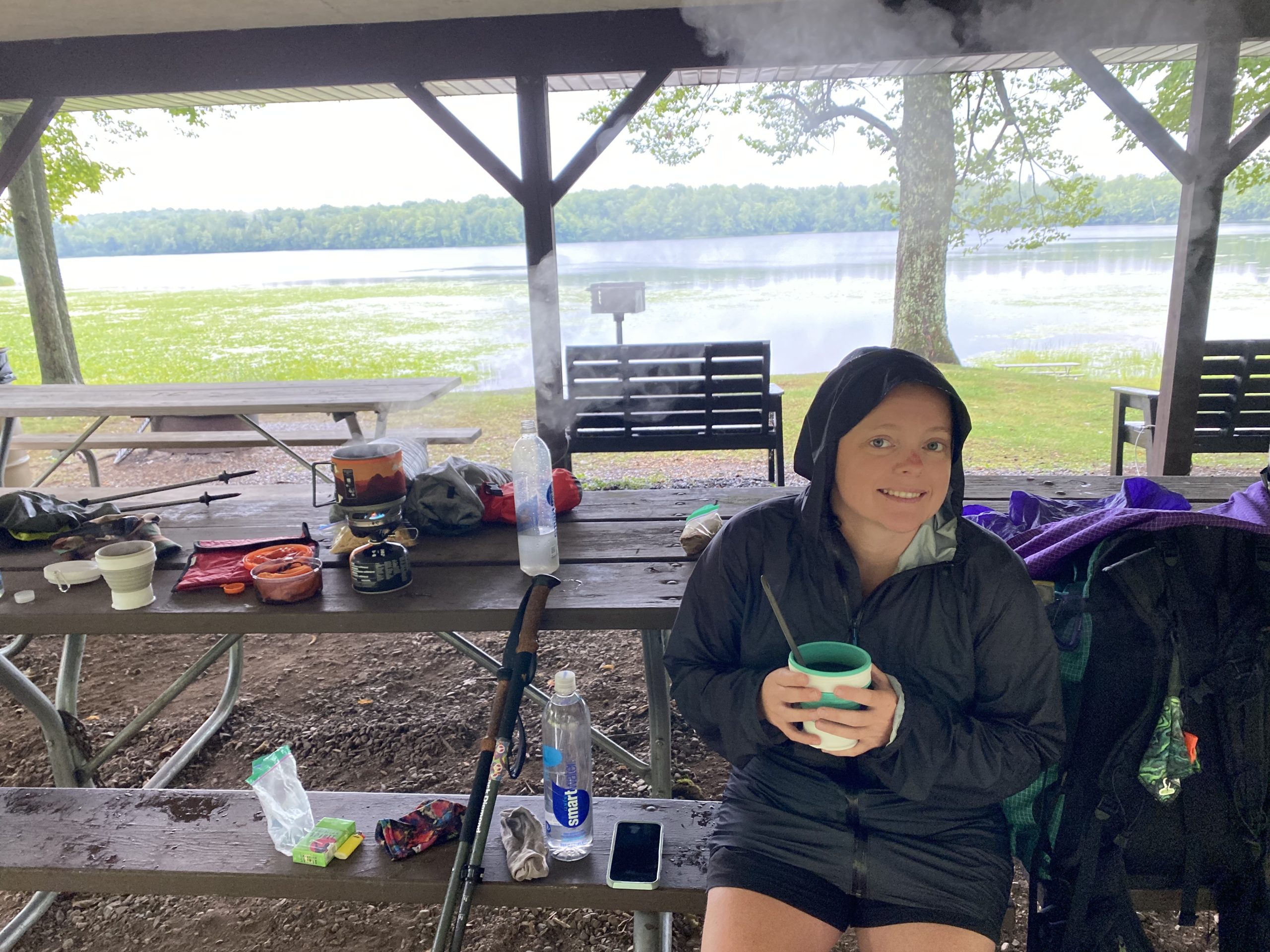
Our 0415 alarm went off, it was still storming. The same was true for our 0500 and 0600 alarms, still storming, and violently so. Our resolve to start earlier was overruled by our desire for self preservation.  We would not be hiking through a storm in the dark.  If the storm wanted to get us, it would have to pierce the paper thin walls of our three person tent to do so.  It did eventually reach inside to get us, pounding rain bounced off water puddles, sending little splashes in at us and our gear.

It was becoming clear that not only were we not going to start our 24 mile day early, we weren’t going to start it dry either.  The best thing we could think to do was pack all of our wet gear up and retreat to the park’s pavilion for coffee and breakfast.  If we couldn’t start the trail when we wanted to, we may as well start it how we wanted to.  It’s like when you know you’re going to be late for work because of some stupid reason that was completely out of your control and you stop for coffee anyway.

It was 0900 by the time we started the trail.  Our 2 mph average would get us to camp after an 830pm-ish sunset.  We would also need to find a time and place to lay our gear out in the sun.  An impossible task that we somehow pulled off.

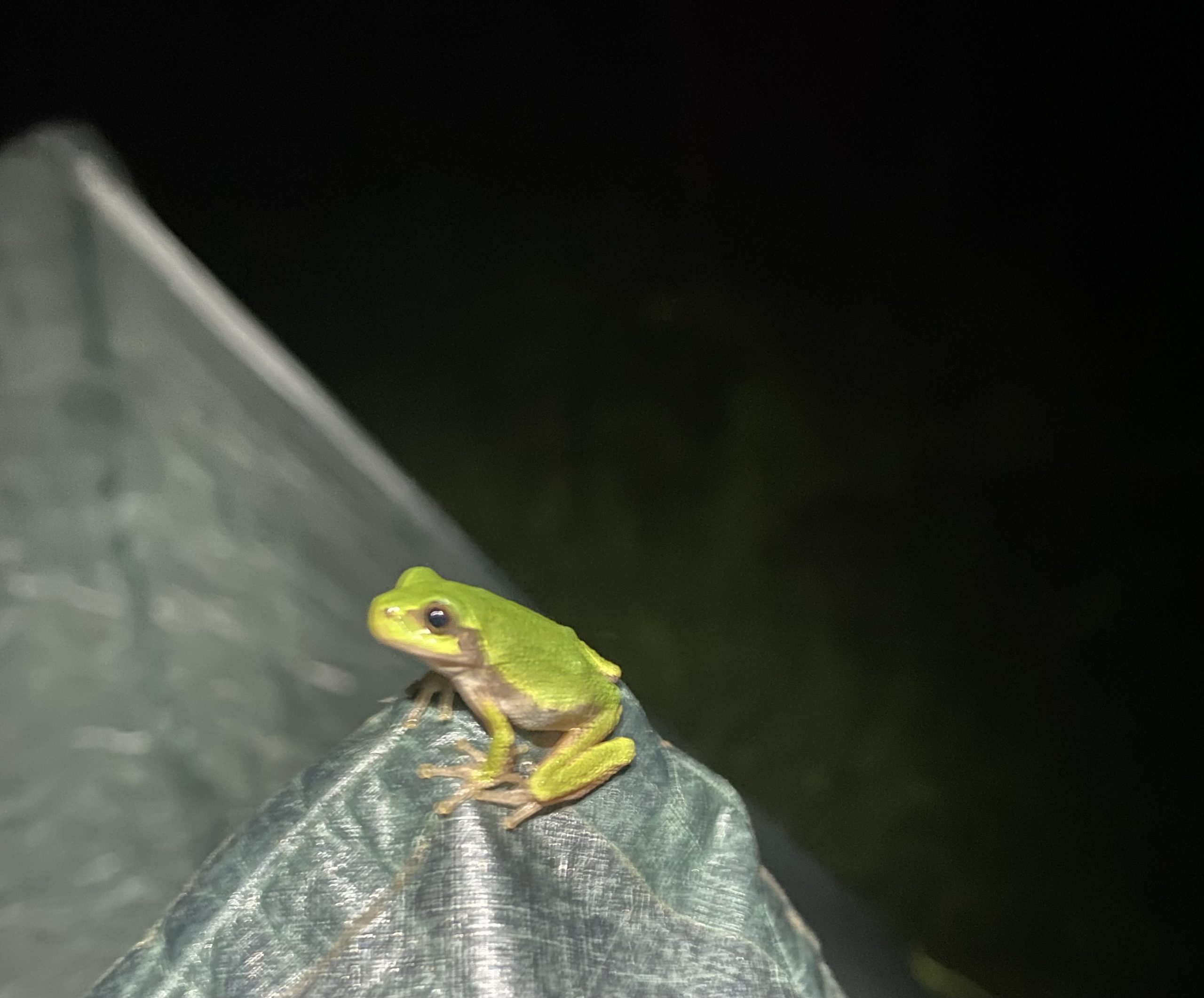
All of our disadvantages for the day also brought advantages along with them.  The storm had kicked us in the mouth, but it cooled the day high down from 88 to 80 and gave us a nice breeze all day.  We needed to make it 24 miles because Ruby was dropping our food off the next morning, but that also meant our packs were almost as light as they could be.  We rolled into our destination site and setup camp just as the final day lights dipped below the horizon.  Mosquitoes were bad, but we were home for the night.

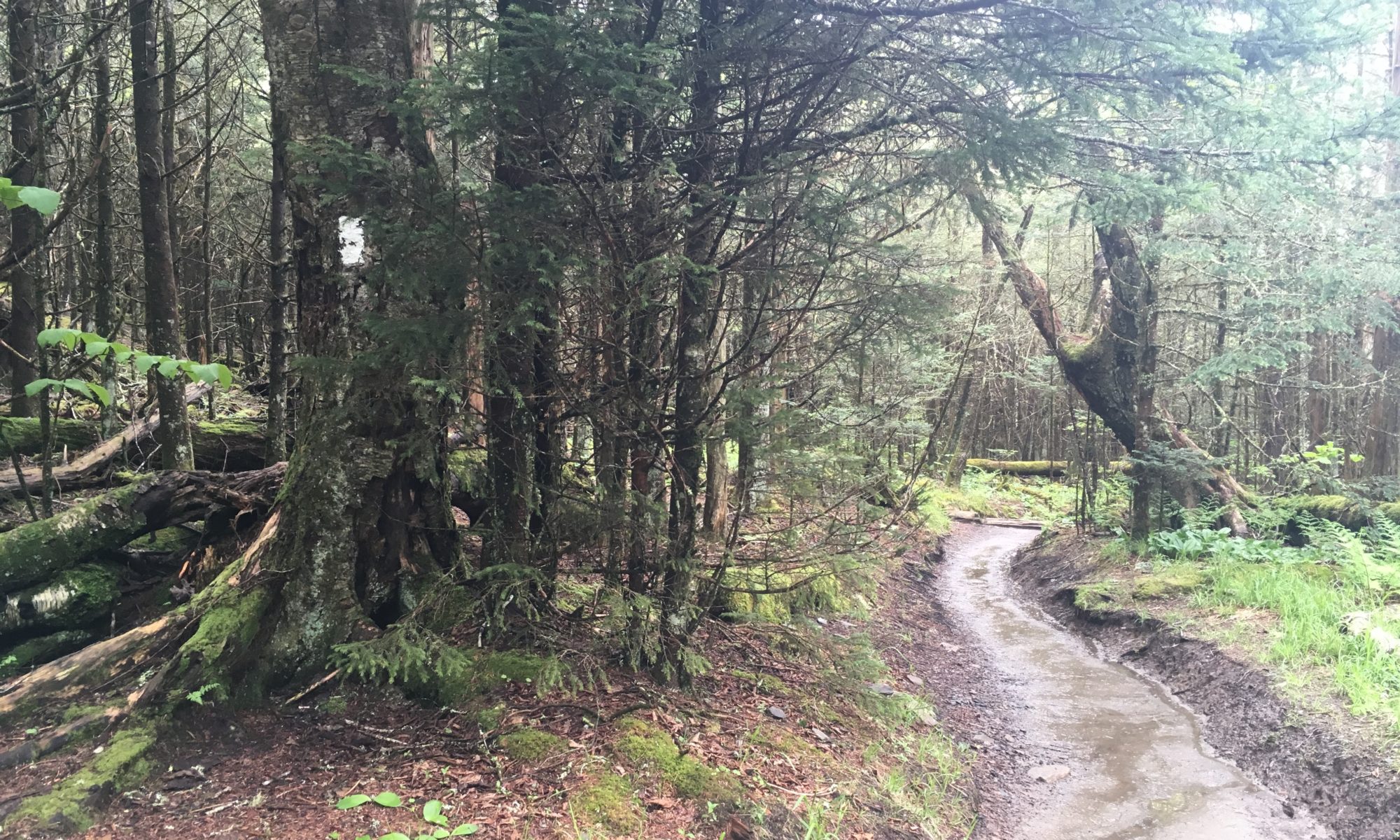
Trails were beautiful and the work our trail coordinators/angels, Ruby and Bruce, do are evident.  The mowed trails were a dream to walk through and the unmowed trails, like the final 3 miles, were a slogfest.

Thank you for all that you do!

Day 20 – IAT Mile 316.5 to 339.2

Ruby and Bruce met us at the IAT parking area just off Burma road @ 0700 as planned.  Brianna & I were in the process of filtering some stream water when Ruby handed over an unexpected 2-liter of water with our food.  I hastily dumped the river water out and filled us back up with the clear water.  Thank you, Ruby!

We chatted for a solid 15-20 minutes about our experiences on their trail and thanked them for all the hard work we noticed through our long yesterday hike.  Ruby reminded us that there is a long stretch with no water coming up, she would be more than happy to leave us 4-liters if we wanted.  Yes, please!  Our list of people who are getting thank you and Christmas cards is growing!

Before they left, Ruby and Bruce stated quite frankly that today’s section of the trail is one of the IAT’s best.  They did not do us wrong here, either.  Half of the day was road walking, but the 10 miles of trail in the Turtle Rock & Grandfather Falls segments were trail gems.  

Turtle Rock took us up the west side of Wisconsin River & Grandfather Flowage.  The trail was riddled with large jagged rocks, making it difficult to both enjoy the rapids and not break ankle, I think we did alright.

Grandfather falls took us down the east side of the Flowage, walking us over an old hydroelectric dam and by large penstocks the waters flow through.  Grandfather falls must be a popular spot for skilled kayakers.  We saw many signs warning kayakers how dangerous the waters are and to proceed at their own peril.  No signs said not to do it, they were more like, “you’re crazy if you do this, don’t blame us if S goes south.”

If I had to guess, I’d say the day began to sour soon after we arrived at Tug Lake park, which was about 4 miles into our 10 miles of road.  Don’t read me wrong here, Tug Lake Park is amazing.  They have bathrooms, a water pump, benches, pavilion, easy lake access.  Fortunately, their water pump was working.  Unfortunately, I noticed right away that it was pumping up brownish rusty water.  I’m not afraid of rusty water, I’m a late 80s & 90s kid, we were still drinking out of hoses and eating paint chips. As a mental thing though, you’re less likely to drink water if it looks unappealing.  It tasted fine, it just looked like toilet water.

We had 8 miles left in our day with about 3 hours of sunlight left by the time we reached Tug Lake.  We could make it to the hiking shelter before sunset if we left as soon as we arrived and put our fast shoes on.  Would you rather hike 2 hours in the blistering sun or wait and hike at least an hour in the dark?  We choose to make dinner at the park and wait it out.

The last road miles of the day came and went quickly, in the shade as we planned, but there was less than an hour left of sun and 3 more miles to push.  Our last section of the day was called the Underdown, not to be confused with the Upside Down, and it was beautiful… in the light of day.  We passed through about a mile of large pine trees called the ‘Enchanted Forest’ before everything went dark.  The Underdown is a combination trail for hikers, horse riders, snowmobilers and bikers.  Trails criss cross like spiderwebs up and down very hilly terrain.  Not the best spot to be relying on headlamps and hiking poles, yet there we were, doing our first night hike on it.

It took us about 2 hours to arrive at our hiking shelter.  As a shelter that is also used in the winter, I had assumed it would be 4-walled building with a door and beds.  What we found upon arriving is that the shelter is a 3-walled open face with benches, a table and a fire pit.  No worries, it’s 10pm and we are calling it a night.

Did we have fun today?  I wouldn’t call it that exactly.  We had an experience and built up our confidences for the next time we find ourselves hiking in the dark.  The goal is to make brand new mistakes next time!

Day 21 – IAT Mile 339.2 to 354.8

Hiker Trash. A saying in the hiker community that I did not fully understand until this trip.  Brianna & I have been seriously hiking since around 2010 when we lived in Colorado Springs, thank you Uncle Tim & Mama Penny!  We lived on the West side of Colorado Springs with easy access to the Garden of the Gods and all the surrounding trails.  Our first major hikes were up the scar and a two day trip up to the top of Pike’s Peak.  We have learned so much since those days, to include what it means to be hiker trash.

Today is an appropriate day to write about hiker trash.  We haven’t had a shower in four days, our clothes are all dirty and we are not going to get a shower or clean clothes for at least three more days.  That, however, is not what it means to be hiker trash.  Hiker trash is being that dirty and then taking it to the next level.  Hiker trash is arriving to a public park where families are hanging out and taking your stinky shoes and socks off to air even stinkier feet.  Hiker trash is laying your dirty underwear in the sun to dry after a severe storm.  Hiker trash is taking a campground shower with your clothes on and then hanging them out to dry like you just did laundry, filling a hotel bathtub with hot water and dirty clothes.  Simply put, hiker trash is choosing to be comfortable with looking like trash and doing trashy things because being uncomfortable isn’t the preferred option.

I guess I wanted to get that out so readers know what I mean when I say ‘hiker trash’.  Before this trip, I thought it was just a thing hikers said to sound cool.  Now, I know that it is a real thing, I finally get it.

Laying on a bench in the back of 3-sided hiking shelter was some of the best sleep I’ve had on the trail in a while.  Midnight elk calls woke us up a couple times, which was more cool than it was intrusive.  A good night sleep rose both Brianna & I’s spirits, having tables to cook coffee and breakfast on with a beautiful view of Dog Lake didn’t hurt either.

We started the day with about a half bottle each of Tug Lake Park toilet water.  Ruby had left us water just 5 miles down the trail, so we ran for that.  I wish there was a picture of us as we reached the water and started guzzling it right out of the old fruit juice bottles she had filled for us.  Water was running down my beard like a dwarf drinking mead on their birthday.

As we sat there, water drunk and filling our bottles, two muscle bound section hikers passed us on their way out for a few day trip.  I didn’t catch their names, but we did give them our blog info (if you are reading this, please comment and let us know how you did during the MASSIVE storms last night).

Clearly water drunk but back on the trail, we made a our first rookie mistake of the trip.  The trail crossed over a logging road and we followed the logging road further than we were supposed to.  Instead of backtracking, we bushwhacked our way back to the trail.  Silly move, let’s not do that again.

Today was hot, 86 degrees with drowning humidity.  What better day to climb Lookout Mountain and the Harrison Hills segment?  Very literally the steepest and most elevation we have done in a single day on the IAT.  Lookout Mountain is only 20ft lower than the highest point in Wisconsin.  Our plan for the day was originally 19 miles, we only made it 15, but for a very good reason.

On one of our many breaks while ascending Lookout Mountain (we hiked 15 miles in 12 hours), Mel texted me a weather warning.  He said that an ugly looking storm was forming in Minnesota and it would likely be hitting us at some point tonight.  What are a couple hikers to do?  The answer, of course, is get lucky.  Just 2 miles down from Lookout Mountain lived a fully enclosed ATV shelter.  A “No Overnight Camping” sign loomed in front, so we called the local Sheriff Dept and told them our plan to crash there for the night out of the storms.  The officer said that he couldn’t give us permission to do that but they would not enforce the restriction tonight as long as we cleaned up.  Deal!

I had texted Ruby and Bruce to ask if there would be water at the ATV shelter.  They replied back, “No, but we will bring you some.” Which they did, plus Sprites, Pepsi and beer :-).  Thank you, Ruby & Bruce!!

Our home for the night is our tyvek ground sheet on a concrete floor with all of our normal ground pads.  Safe.

Day 22 – IAT Mile 354.8 to 381.3

One hell of a storm last night.  If we had been in our tent through that… I would be writing a very different post today, if at all.  We could hear the winds raging and the rain pounding.  Thunder and lightning was popping and cracking faster than I could count “1 apple, 2 ap”.  We heard large trees being ripped out of the ground from their root balls.  This was serious shit.  Thanks to the ATV shelter, we started our day both dry and healthy.

If you read the title of this post and did the math, you already know we hiked 26.5 miles today.  The end of Harrison Hills and the beginning of Parrish Hills are very challenging with the ups and downs, this morning we also had to navigate around and over many tree blow downs.  When we weren’t in the hills, we were dealing with bogs and miles of thorny overgrown raspberry bush trails.  We started hiking around 0645 and didn’t get camped until 1030pm.  We road walked in the dark and didn’t see a single car in all the 4 miles.

When you’re at a mental breaking point and still 3 miles away from camp, at least another hour, it’s gut check time.  You have more than one semi-serious injury and you are exhausted. This is what you signed up for.  No one is coming to save you.  Is it an adventure or a miscue?  I’m not sure if I picked my mental fortitude in the Air Force or if I’ve always been this way, but I say it’s an adventure.  However, this adventure is not just about me and I am trying my best not to push the team of us too far too fast.  I can see Brianna getting mentally and physically stronger and that’s a powerful beauty to behold.  Some of life’s endeavors worth pursuing.

Day 23 – IAT Mile 381.3 to 388.8

Hike. Storm. Hike. Storm.

Camp for last night ended up being on trail, tent pitched over lumpy 2-track grooves.  The kind of ground you have to work your hips into just right before sleep can happen.  Setting up on the trail is generally frowned upon, but we leave no trace, and generally do not want to go wandering in the unfamiliar woods at pitch dark.  Our frog friend approved.

If you’ve been reading posts from this hike and our other hikes, you may have noticed how difficult days are sometimes followed by unbelievably magical days.  The trend continues…

Our day started with more weather updates from Mel.  Another huge storm was headed our way, due to arrive around 4pm and hit harder than what happened on Monday.  This wasn’t a complete surprise, it was part of yesterday’s motivation to tap out 26.5 miles.  Today’s original plan was for 24 miles, set ourselves up to finish the IAT West Section on Thursday.  With weather being what it was to be, finding shelter became the new priority.  There was a shelter near mile 22, but there is no way we could make that distance by 4pm.  There was also a campground with cabins around mile 9, but they took damage in the previous storm and had not yet recovered.  What are a couple hikers to do?  Get lucky, again.

One of the tools Brianna & I use to find campgrounds and businesses while on the road is Google Maps.  Google Maps is really helpful when you’re scanning around unsure of what you’re looking for, more options and info.  During my Google Maps search for nearby shelters, I happened upon an unusual icon very near the trail, it had a phone number and no description. “Can’t hurt to call, right?” I said to Brianna, tapping the phone button.

A gentleman by the name of Jason answered the phone.  He laughed when I mentioned his information being listed on Google and apologized that it was not accurate, we could not stay there tonight.  We bantered back and forth for a bit, mostly me picking his brain on which sites might be safest for us during a big storm.  He thought getting a hotel in the nearby city of Antigo would be best. I explained that we would love showers and fresh food but have no way to get to the city or back to the trail. He responded, “let me call you back, I might be able to help.”

What a crazy turn of events.  Brianna and I had no idea if we were about to get a ride into town or sleeping in the woods somewhere, so we kept hiking in the direction of a ski lodge, Spychalla Lodge, that would be our best bet if our new friend couldn’t pull something together for people he didn’t know or have any responsibility for.  The Spychalla lodge is a beautifully built ‘no camping allowed’ building for skiers to enjoy, but I think Spychalla would have approved of us.

It couldn’t have been more than 15-20 minutes before Jason texted me, “My dad is in the area and will drive you to Antigo this morning.  I have a meeting that way tomorrow and will get you back on the trail by 0700.”  And that’s how it all so randomly happened.  Jason’s Dad, Ken, was in the area and heading back to Antigo, so he stopped and scoped us up.  After a tour of the city, he dropped us at the Sleep Inn where the awesome desk worker let us do an 11am early check-in.

We are showered, our clothes are clean, we are once again safe from the storms. Two more days of hiking and we will be passing through Antigo again, can’t wait!

Day 24 – IAT Mile 388.8 to 413.2

400 miles!

Jason picked us up from the hotel a little before 0700 and shuttled is north to where his dad picked us up yesterday.  The entire series of events is pretty random, but even more random is that Jason and his family are taking a trip to Michigan’s Upper Peninsula next week.  He had a lot of questions about the North Country Trail and popular sites that Brianna and I were very well equipped to answer!  Jason also has a friend hiking the Appalachian Trail this year, he said it was fun helping hikers close to home in honor of his friend.

Thank you, Jason & Ken!  We will pay your kindness forward 🙂

Brianna & I were able to start the trail by 0715.  Today was a real mixed bag of hiking.  The first 10 miles had a lot of tricky tree blow downs we had to navigate.  Every blow down is different, a riddle in its own right.  How do we get around a huge tree with bogs on each side?  How do we get over a huge tree with steep declines on each side?  I like riddles, but they were physically exhausting us.  I’m very thankful we did not have to navigate Harrison Hills after the storms.

The last 14 miles of our day were very easy.  Rough trail turned into hardened dirt paths through shaded forests with few blow downs.  We finished the day halfway through the Kettlebowl segment, an area we had read to be very challenging and easy to get lost in.  Overall, we found it to be very well marked with yellow blazes.  It had rolling hills that were easy to keep pace on and not steep at all.  I don’t know that we would recommend that segment to a friend, but it was not high on the difficult meter.

If I was to pick a most notable part of today’s hike, it would have to Bakers Lake.  Bakers Lake is the last place to fill up on water for 17 miles.  There is no water in the Kettlebowl, you have to hike all the way over to a Park in Polar Township before another opportunity arises.  Brianna & I knew we would be dry camping, so we filled up with 3 liters of water each, had dinner at the lake, really took our time before making the day’s final push.  Bakers Lake is positioned right on the edge of the Lumbercamp segment, making it easily accessible if anyone ever wanted to come back and fish it.  Fish were hitting the top of the water with big splashes the entire time we were there.

Home for tonight is nestled between and beneath some small pine trees where the ground is soft and the sleeping is easy.  Our goal for today was 24 miles and we made it before dark.  It is also the last time we will be able to primitive camp anywhere we want(where allowed).  From here on out, it will be parks and IAT designated areas only.  Feels right that our last free camping night was in the pines, one of our favorite places to be.

Day 25 – IAT Mile 413.2 to 431.8

We made short work of the last few Kettlebowl miles this morning and began the long road walk into Polar where we would resupply on water and take a proper long lunch break.  A man in a Razor stopped us on the way into town and asked how the Lumbercamp trails were after the storms, any intel would be valuable as he is one of the main caretakers.  I thought we were dropping some bad news on him, as that was one of the worst areas we have past through, but he didn’t seem to think they were that bad, even after he saw the pictures.  I’m sure he knows more than I do, have at it, sir!

Polar is a small town sat on big water, Lake Mueller.  Except for the bathrooms, which were so nasty I do not have the ability to write about them in polite company, Polar Park was very well groomed with a clean little patch of sandy beach.  There is upper polar park, in the shade of many trees where we had lunch, and there is lower polar park where the beach, public docks and all the other people were.  Brianna & I decided it would be a hot lunch kind of day, so she heated water for our ramen and salmon while I put the tent up to dry.  Because of dew, drying the tent out is a daily affair even when it hasn’t stormed during the night.

The remainder of our day was pretty uneventful.  We road walked into the Langlade County RV park, our home for $10 a night, with showers, water, electricity and trash!  The park is next to a baseball diamond and was especially busy because of a local tournament that was happening.  No matter to us, we resupplied at the local super market and ordered cheeseburger pizza for dinner.  It’s not a quiet night, but it’s good to be in a town and off the roads.

Day 26 – IAT Mile 431.8 to 007

Global reach, global power.  GRGP was a term I heard often in the four short years I spent as active duty enlisted in the Air Force.  To sum it up, GRGP is the military’s ability to touch anywhere in the world,  at any time, within x amount of time.  We drilled it, we executed it.  Touch having many different meanings, though I can’t remember a single time we drilled to meet a humanitarian related objective.

As hikers, Brianna & I have nearly zero reach, zero power.  Our ability to touch specific locations is dependent on things like physical health and caloric intake, hours in a day and average rate of travel.  However, we are not powerless.  Our power rests in the small footprints we require and leave, to be so small as to go undetected or ignored, it makes no matter which.  If it can’t be seen, it can’t be targeted.  We are secret agents of obscurity?

Sleep comes early these days and last night was no exception.  Prior to passing out, Brianna and I stuffed our faces with food and attempted to riddle out what the next few days of trail might look like.  The next camping area is 20 miles away, Dells of Eau Claire, a doable hike but the campground is full for the weekend.  The next closest camping spot is 10 miles after Dells of Eau Claire, a 30 mile hike… that is pushing it.

We reached out to all of our usual resources, the local coordinator, the Facebook group, various maps apps; we found nothing.  The local coordinator mentioned that the camping spot after Dells of Eau Claire was where a tornado had hit during the latest storm.  She warned of copious blow downs and a chance that the designated camping spot may not exist when we get there.  A 30 mile day through tiring blow downs with a chance of being screwed upon arrival.  Ok, sweet.

Trail coordinators are very helpful and often very funny.  On more than one occasion we have had them ask us how far away our car is.  I’m guessing most of them don’t deal with thru-hikers very often and aren’t sure what it means to thru-hike.  Brianna and I always laugh and sheepishly reply, “Our car is in Michigan.”

This morning’s hike started windy, hazy and cold, with an air quality alert due to smoke from Canadian fires blowing down our way.  After much debate, the only real plan we could come up with for the day was to hike the 9.5 road miles into the next trail and see what happens, do what we have to do.  The road miles were actually pretty fun, we passed a huge dairy farm and lumber operation.  Dairy cows were chomping down some breakfast but did raise their heads to acknowledge us as we passed.  The lumber operation looked like a prison from afar and was very busy for a  Saturday from up close.  Earlier this week Ken had told us that lumber is one of the main industries in Antigo, trees seem to get smaller and smaller every year.

Once back on the trail, we came upon a boardwalk observation deck; a perfect place for lunch.  Lunch time came and went quickly with still no plan for where to camp or what the next best move might be.  Here is what we did know: we were both tired and a 30 mile day, even if halfway there by lunch, was not going to happen.

Without going into too much detail, we did find a place to camp and were passed out by 6:30pm.  

Day 27 – IAT Mile 007 to 470.3

We had camp broken down and were on the trail by 0550 this morning!  Left no trace!  The initial morning push only lasted about an hour before we both started bellyaching about needing breakfast and coffee, so we stopped at the nearest IAT bench and did the morning routine we usually do before leaving camp.

Injuries on the trail are very different than injuries in normal life.  If I pulled a muscle working out in my normal life, I would probably take a week off and let it heal because injuring myself worse could really throw my routine off.  Injuring myself on the trail, like I did to my calf, like Brianna did to her shin, you just keep limping on and hope that it heals or the surrounding muscles get strong enough to pick up the slack.

Long hiking days like today have a way of bringing old injuries back.  All of today’s segments, Plover River, Thornapple, Ringle, they all had huge blown down trees.  Ringle segment was by far the worst. There were many spots where trees weren’t just blown down, they were twisted like pieces of braided rope.  They say a tornado went through and I believe it.

Overall, even with the trail damage, today’s hike was beautiful.  Going over, around and under trees was more like a Tough Mudder event than a chore.  If the trail is well maintained, going around a tree can be fun.  If you’re going around a tree and dealing with bogs and/or high grass, that’s no fun.  Ringle getting hit so hard is super unfortunate, as this is a new area the IAT had planned to complete work on later this fall.  On the other hand, we have talked to the trail coordinator for this section a lot, Gail, and she has her shit together.  She is already out there with chainsaws and a crew.

We have been on the trail for 27 days and I’m still trying to wrap my head around this whole “Ice Age Traill Alliance” thing.  Trail coordinators, the people who manage specific segments, are all volunteers.  I have to believe that the skilled labor, the people with chainsaws and hammers, are getting paid something.  Ruby and Bruce told us that all the trail maintenance equipment is bought by the IAT and the building of shelters is contracted out with very precise specifications.  They laughed about how one 3-sided shelter costs 6-7k once it’s all said and done.

I would really like to research the top of the the IAT organization more.  With all the legal work and paperwork that’s required to string this thing together, someone has to be getting paid big money, right?

Towards the end of our hiking day, we arrived at Dollar General for a planned resupply.  Brianna must have been in the store for an hour trying to find where things were and deciding which foods to get for our future breakfasts, lunches and dinners.  She must have made friends while wandering the store, soon after she came out with our supplies a gentleman gave us each our own ice cream Snickers bar!  After devouring our dessert, Brianna hung back and organized supplies in the parking lot while I sprinted over to Subway to grab us a couple Italian BMT footlongs.

With full stomachs and heavier packs, we road walked the final 4 miles south to a cozy designated camping spot just 30 yards off the highway (Rice Lake).  We are under the pines again 🙂 Tomorrow will be a lot of road walking.  Having more food is cool, heavy packs suck.

Day 28 – IAT Mile 470.3 to 489.7

Philosophies of a Thru-Hike, Part 1

Today’s hike was a frustrating road walk that ended in a shorter day than we had hoped.  We ended up putting in a call to this area’s local coordinator, Debbie, who drove us ahead 10 miles to the shelter we had hoped to hike to.  But I don’t want to talk about today, I want to talk about why Debbie is picking us up in the morning and driving us backwards 10 miles to where she picked us up.  I want to talk about the different philosophies of a thru-hike.

This hike has taught Brianna & I something we never knew about each other before, we both define and approach a thru-hike very differently.  

Brianna’s approach is what some might call a ‘purist’ approach, I’d call it Kantian.  Every mile must be hiked, to skip a mile would be a bad action and bad actions are never ok.  At a very base level, Brianna believes that by definition, a thru-hike is only a thru-hike if you hike every mile that can be hiked.  Hard to argue that point, right?

My approach is what some might call the ‘whatever works’ approach, I’d call it utilitarian.  If skipping 10 road miles is going to lead to more fun, or good, then I’m not going to lose any sleep over it.  Don’t tempt me with a good time.  If I begin a hike on the west side of Wisconsin and finish on the east side, the details of how many road miles I did or did not do are inconsequential.  I thru-hiked it.  Maybe I didn’t follow gospel to the word of it, but let’s not get into a conversation about gospels and the two thousand years worth of translations.

If you think these differing approaches cause us conflict, you would be wrong.  I would be ok with skipping road miles, but that doesn’t mean I’m against hiking them, it just means I don’t care, that I do not place value in the action.  If hiking every mile is important to Brianna, then the way for me to have the most good, or the most fun, is in hiking every mile.  If it comes down to the wire and we need to skip forward to make the IAT Eastern Terminus, we would probably only do so with the intent to come back and finish next year.  A fair and reasonable compromise.

This topic is actually a hotly debated one in the hiker community.  I might even be labeled a heretic for my stance, or lack of a stance.  Wait until I write Philosophies of a Thru-Hike, Part 2, where I’ll be discussing laws and how they don’t apply to all people all the time, namely me.

All that aside, our shelter for the night is awesome. We have a roof and electricity, the latter is pretty unheard of. Here is to hoping tomorrow is a better one!