Three Sisters Wilderness Area

Waking up at 5,281 feet of elevation this morning was pretty chilly. Mercifully, the morning did not have the strong winds that rocked us to sleep in the tent last night. A hot cup of coffee and a warm breakfast fired us up right quick!

Icy Street Shoes

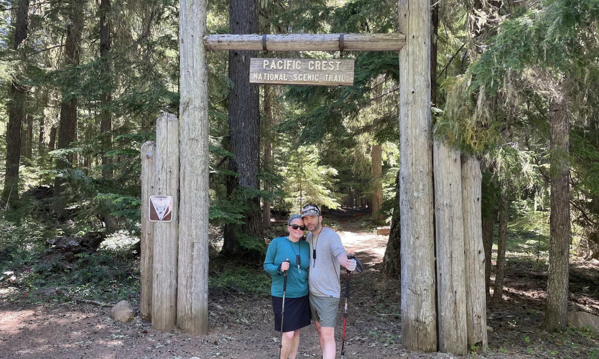
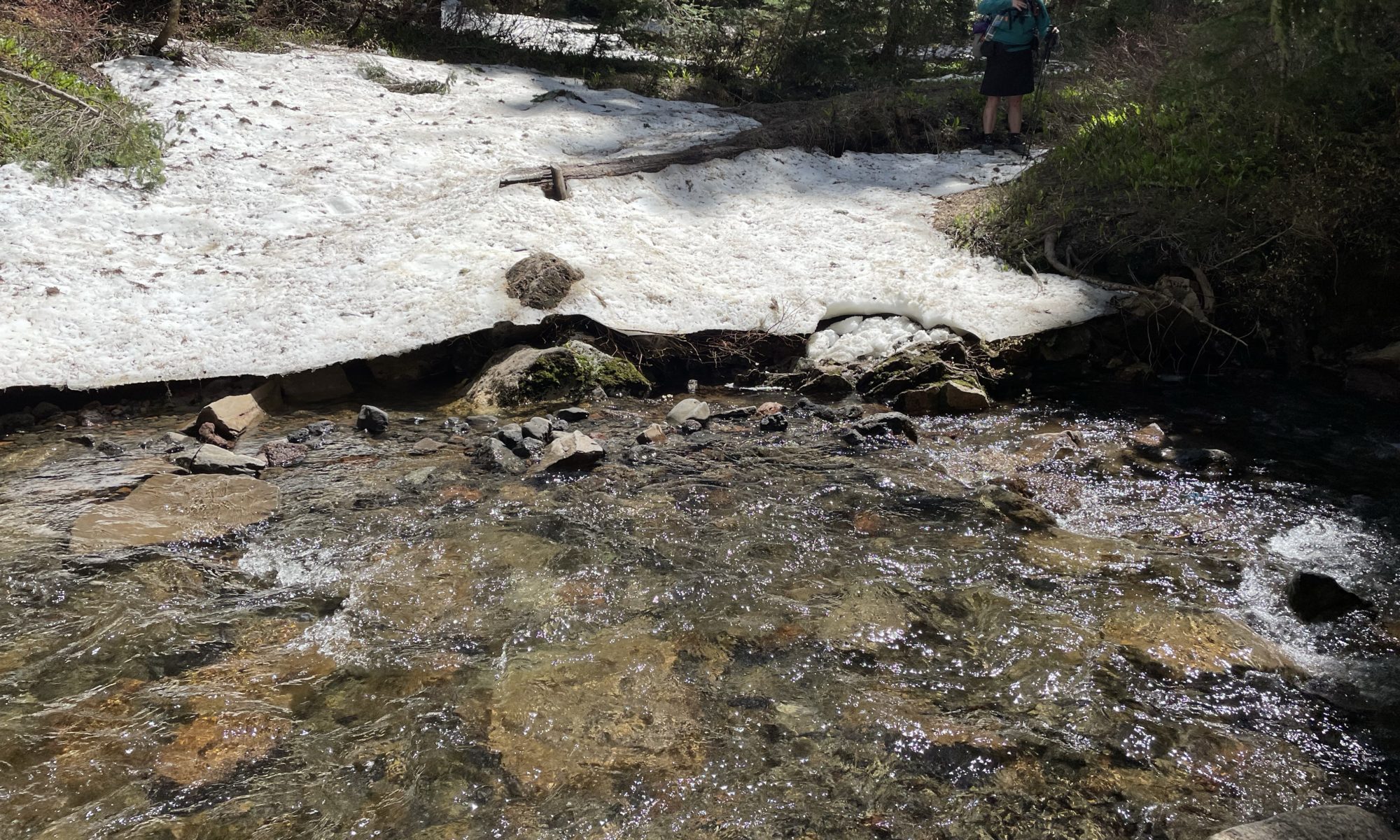
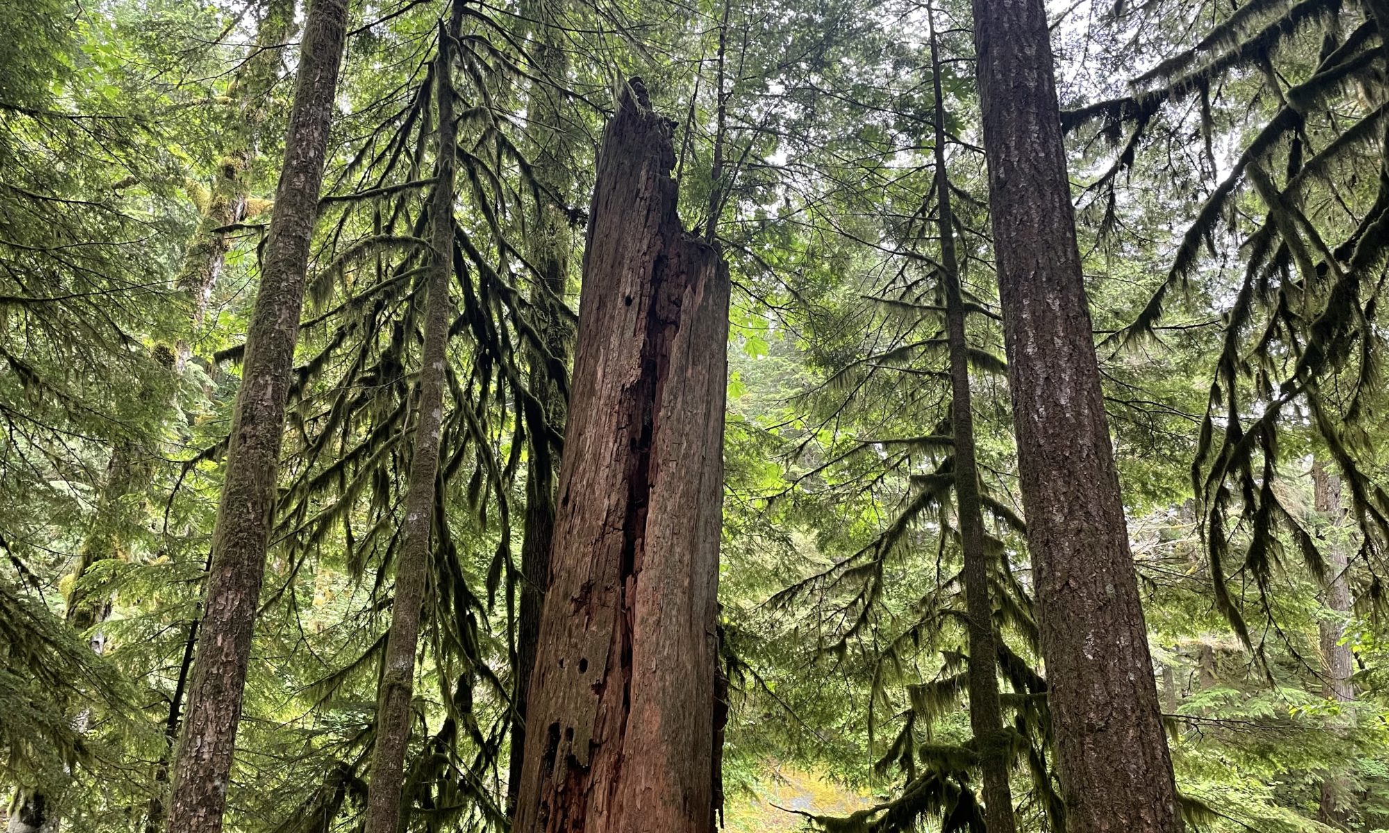
Remember from a few days ago when I wrote about Mount Hood? I said something to the effect of, “a non-hiker in street shoes could do this.” Well, today I got to witness that very feat while hiking through the snow in the Three Sisters Wilderness Area. Today’s snow was much longer and more significant than what was at Mount Hood, not nearly as bad as Indian Heaven was a couple of weeks back.

Brianna and I were hiking along at our normal pace, slowed a bit by the snow, when we came to a single ledge crossing through the snow. A family of four was hiking down towards us, a mother with two daughters and a son, so we had to wait for them to finish before making our way up. The family was going so slow that Brianna and I stood in the shade and just watched everything unfold.

The daughter in the back decided she did not want to wait for her family and took a glissade down the hill on her butt; it wasn’t graceful but it worked.

The rest of the family slowly stepped their way to the end of the 40-yard stretch, the mom very cautious, the young son of maybe 12 downright panicking. He panicked so hard that he somehow dropped one of his hiking sticks. 

I watched his hiking stick slide halfway down the hill, stopping well out of anyone’s reach. The mom yelled, “Romona, go get your brother’s hiking stick!” It didn’t take a rocket scientist to see that Romona was not equipped to climb up a hill of hardened snow, basically ice, to get her brother’s hiking stick, so Brianna advised them not to panic while I put my microspikes on and took my backpack off. I felt like a superhero, walking on the unwalkable with ease, making it to the orphaned piece of equipment without breaking a sweat.

“Can you bring it up to me, please?” Was the next thing I heard. Sure, kid, my EMT-B skills are a bit rusty and I’d rather not go that route. The moment I handed him back his hiking stick was the moment I noticed that this kid had Air Jordans on. Wow, good on you! Could have been avoided by a little bit of research and preparation, but good on you for making it! I climbed back down and the family successfully finished their trek down off the hill.  They thanked us profusely and we parted ways like strangers in the night.

Trail Details

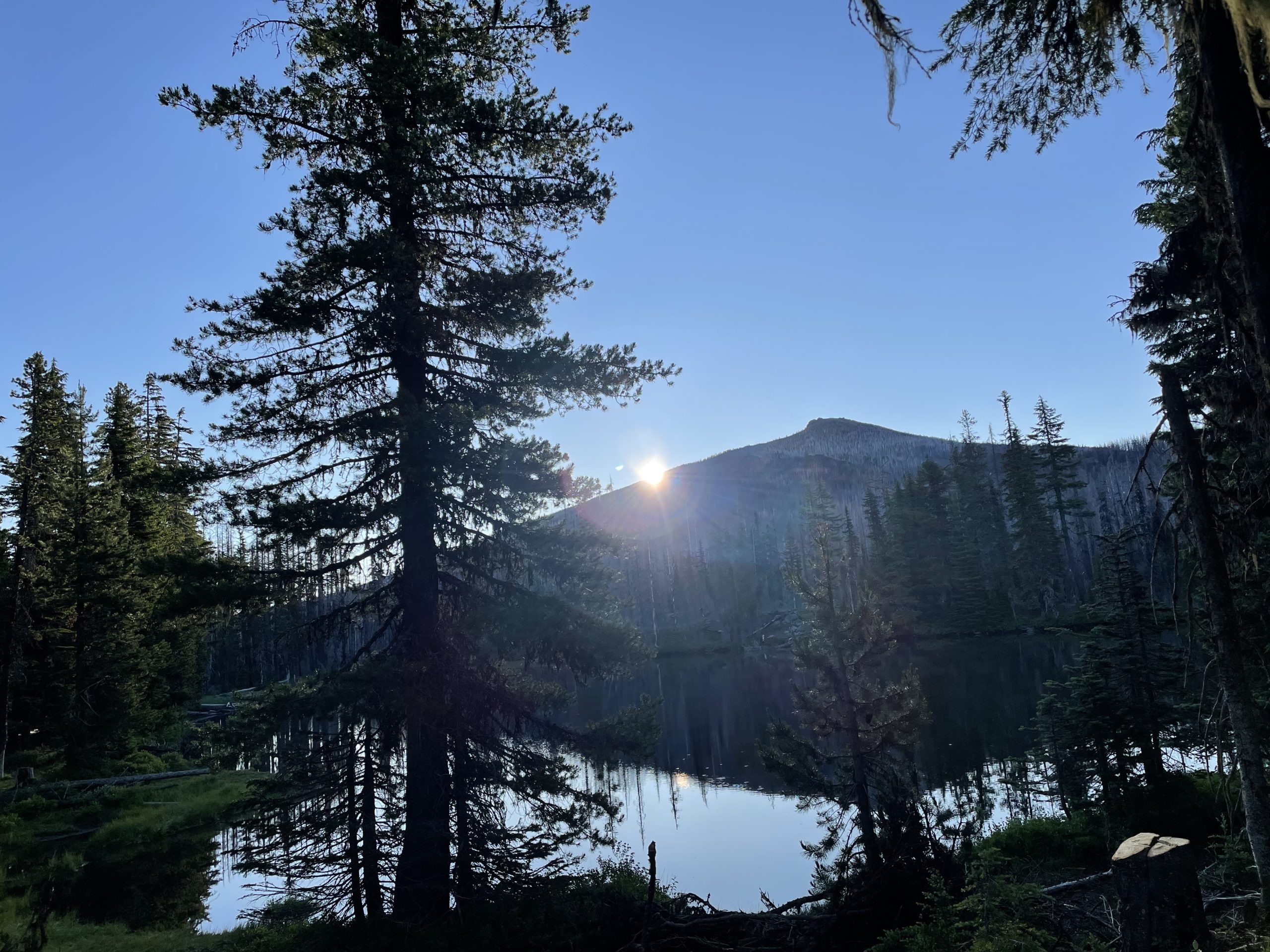
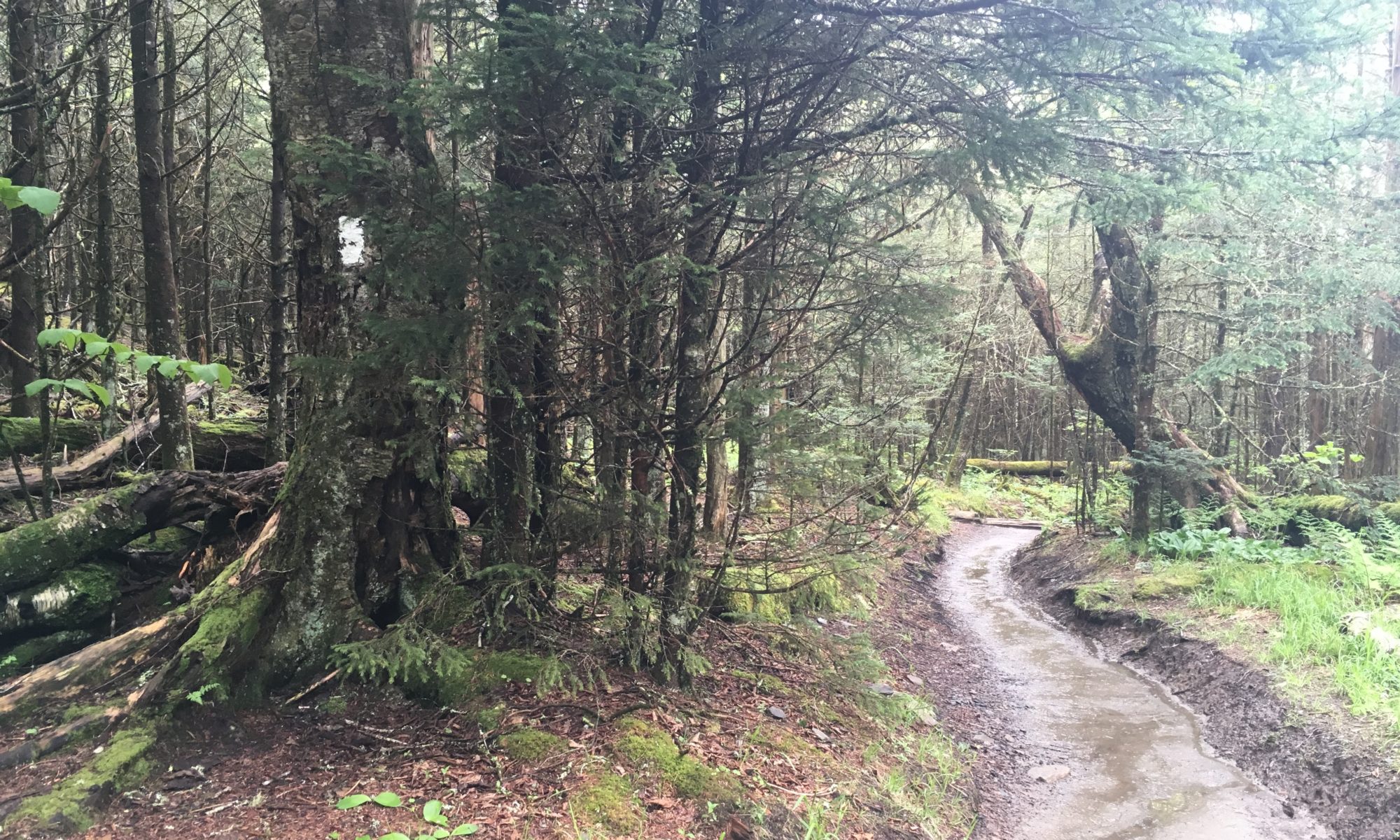
The rest of the hiking day was par for the course, challenging and beautiful. Snow here isn’t dangerous, there are just 6-8 miles of it to slow you down. Brianna and I hike at about 2/3 speed over slushy snow, making it 8 miles over the same span of time we would normally have done 12. It is, for this reason, I was ok with setting up camp after a 16-mile day, well that and the spot is next to Reese Lake facing the beautiful South Sister mountain.

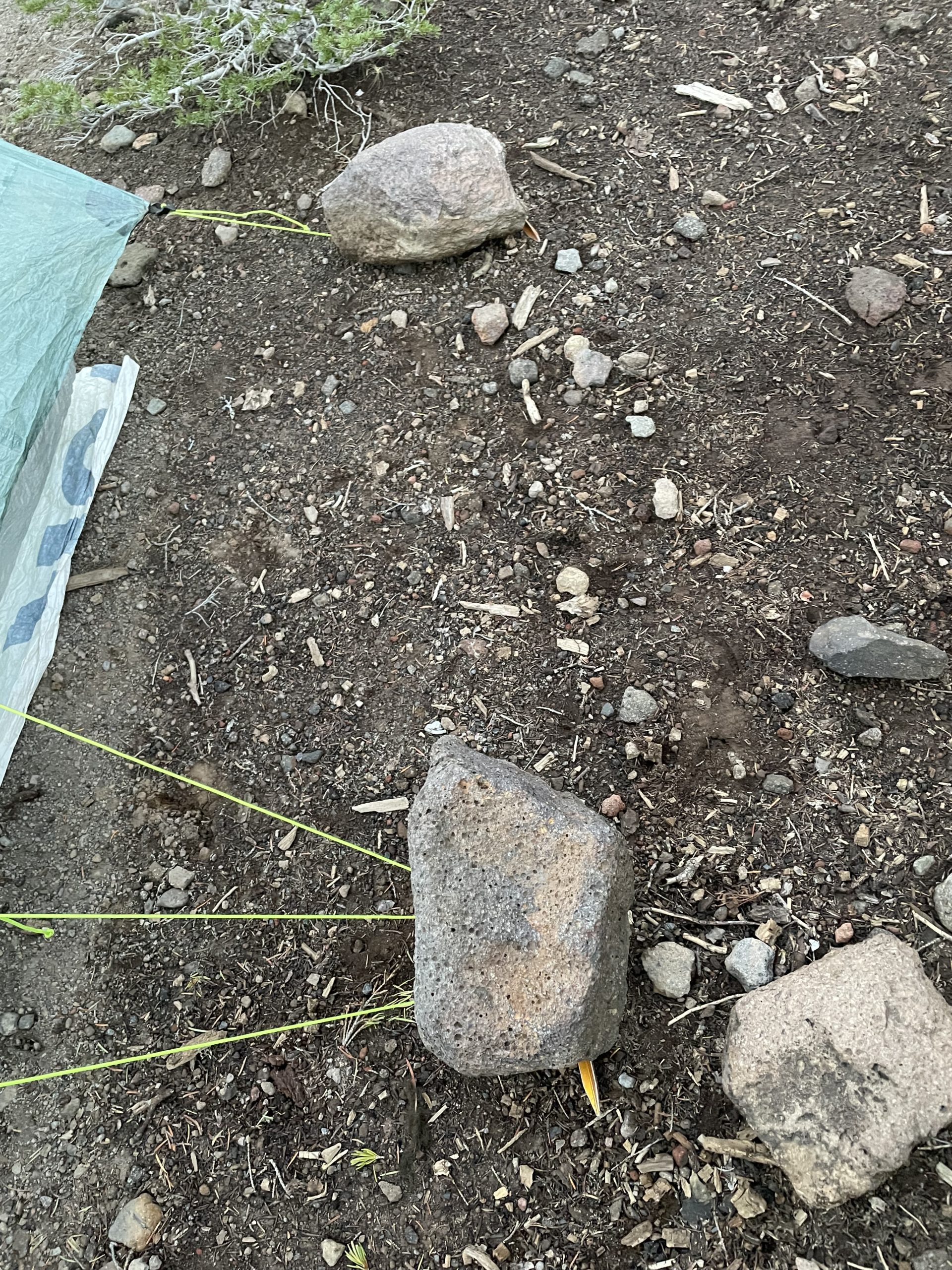
Our tent setup is a new one for me. The ground here is too hard to hammer in stakes so we have the stakes through the tent ropes and T anchored by large rocks. Home is a little lopsided, but it’ll do.

Waking Up to the Sister

The mornings we have overnight oats always start out faster than the hot breakfast mornings since there is much less involved. Getting out on the trail early is one of my favorite things to do, unfortunately, it’s also one of the things I’m worst at. Do I drink coffee or get lower temperature miles in and look for wildlife or enjoy a hot cup of coffee?  This morning we did both. 3 bucks with nice racks fled from us as we started the day.

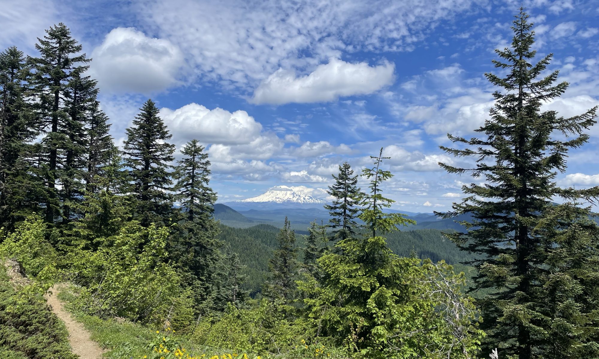
We ran into a lot of good hiker conversation on today’s trail. Trails weren’t filled with lava rocks or snow for a change, so we had plenty of time for breaks and small talk. The only real obstacle we ran into today was mosquitoes and they aren’t even that bad yet. Contradictory to my previous post, all of today’s hikers were Americanos. We swapped Indian Heaven hiking stories with an older gentleman and discussed bug mitigation strategies with an older gentlewoman.

Categories

I have been thinking more about the comments I made a couple of days go about there being more international hikers than US hikers crossing our paths thus far. The real truth might be that hikers of different nationalities and age brackets are more inclined to stop and talk to us, where the younger hikers typically walk right on by with very few words, if any. 

Most people on the trail fall into one of three major categories, college kids, international, or recently retired. Brianna and I fall into a microcategory of 30/40 year olds. International hikers and those of the recently retired approach us and we reciprocate with meaningful conversation. I’m sure many of the younger hikers would reciprocate if we engaged them, it’s just not something we have attempted yet.

People on the trail are as finicky as they are in real life. I like to say a quick, “hello”, and attempt eye contact when we see northbound hikers coming our way. Most of the time, we will get a kind greeting and a smile back in return while other times people are so focused or uninterested in conversation they wear hard facial expressions that all but scream, “do not talk to me.” I still say something, just to confirm. Everyone is going through their own journey and responding to salutations from a stranger is hardly a requirement, but I do notice. It’s like playing heads-up poker for a single hand with hundreds of different people. Did I read their expressions correctly?

This trek ends in Elk Lake tonight. We got a fancy yurt to stay in for the final night of Curt and Penny travel time. We started the trip in a yurt in St. Ignace and we end it in a yurt here in Elk Lake.

Mount Washington Wilderness Area

Hiking Mordor

Today’s trail was the kind of experience that starts super cool and unique but finishes with a big, “fuck you.” 

When I asked Brianna if she would recommend this trail to one of her friends, her response was, “For sure, if they enjoy hiking in the sun and walking on lava rocks all day.”

While this area south of the Lionshead fire area is open, fires did hit the land very hard. We hiked many miles through a boneyard of charred pine tree forests, completely exposed to the sun. Making it through the burnt and barren lands was rewarded by more exposed hiking on lava rocks of all sizes for about 5 miles. If you’ve ever used one of those electronic foot massagers and left your feet in there too long, it was like that over a 3 hour period. Our feet were obliterated by the end of the day. I now know what Sam and Frodo’s feet must have felt like on the walk to Mordor.

Unsurprisingly, my favorite part of the day was reaching camp. Brianna found a sweet spot just 1/4 mile off the PCT, Lava Lake Campground: flat camping spots, bathroom, picnic tables, lake, no fees. It was a long stretch without water, so the warm lake water is what we really needed, everything else was just a huge bonus.

We set the tent up, had dinner, and called it a night pretty early. Beautiful spot right on the edges of satan’s chainsaw.

Internationally Interesting

Interesting trail fact – thus far, we have run into more international hikers than we have US hikers. This anecdotal piece of information is based almost solely on accents and those who converse with us to exchange stories. It could be that Americans just don’t want to talk to us, or it could be that the international hikers are faster. Brianna and I are hiking south, which means the first group of northbound hikers we are seeing are the fastest.

I have met 5 self-confessed English guys, none of which knew the whereabouts of RAF Lakenheath, where I lived back in the day. It amuses me that people from the UK refer to themselves as their specific area when asked where they are from – England, Ireland, Wales, Scotland, they never say ‘United Kingdom’. When I lived in the UK and told people I was from Michigan, people would look at me and ask, “what country is that?”

South Side of Mount Hood

Dry Climates and Me

I can feel the air becoming drier as we hike further south into Oregon. No, seriously, my skin is reacting negatively to the lack of humidity in this region of the country. A little-known fact about me, I have a skin condition that causes painful rashes to present when I get too hot, as when wrestling or hiking. It’s easy enough to control at home, so much so that no one would really notice, but it has been a new challenge out here.

Last year’s Ice Age Trail hike through Wisconsin didn’t cause me any real problems because it’s so damn humid out there. It’s been a different story here on the west coast, where desert dominates the landscapes. What I have learned so far is that I cannot wear cotton or polyester. The best options I’ve found have been merino wool and Patagonia sun hoodies. These rashes are painful and even go so far as to create open sores that bleed. I did not know exactly how my body would react before I got here, am adjusting on the fly now that I’m learning.

As a Michigander, it’s difficult for me to understand what draws people to live in these super dry areas. If you add up the time I spent in the deserts of Pakistan, Kuwait, Idaho, and Colorado, I’ve spent a solid 5 years of my life in this type of climate (caveat: I would totally live in Colorado Springs again). Coming back to Michigan after a stay in the desert always feels like I’m walking into a Dairy Queen after 7 days on the trail. In Michigan, we have freshwater lakes surrounding us, great and small. We have regular weather events like thunderstorms and rain clouds. 

The forecast for this area of Oregon over the next 10 days is sun and more sun, dry and drier. This whole area is a tinderbox waiting for a spark. Fingers crossed for a healthy wildfire season.

Trial Details

Hiking southbound down the south side of Mount Hood was the easiest days we’ve had so far. Downhill and cool breezes made for happy days. The trail all around Mount Hood is beautifully maintained, and parts were even wide enough for us to walk side-by-side. Today was also the first time we’ve passed people on horses; much of the trail is available to both hikers and horse riders.

We will be jumping over the Lionshead fire closure tomorrow. Total miles missed will equal around 75. 

Without mentioning any names, I can say that we have passed several people who ignored the trail closure and just hike right through in a single day. No part of me wants to miss the beauty of Mount Jefferson, but it’s just not something Brianna and I are comfortable doing. Forcefully skipping miles on a long trail happens and ignoring closures would be us being selfish. Being selfish does the hiking community no favors. It’d be like pooping in the middle of someone else’s campsite while making direct eye contact with them – awkward and unnecessary.

Mount Hood Wilderness Area

Cold Start

This morning was so very cold. We camped at Still Creek campground next to a creek. As beautiful as the campground was, our site didn’t have many flat spots for tenting, so I broke out my hammock tent and set it up perpendicular to Brianna’s hammock tent. The chill running through my body all night and into the morning had a few different causes:

1.) It dropped to 40 degrees this morning.

2.) I have a thermal barrier to lay on that is supposed to keep my body heat in and I was only partially on it.

3.) My hammock tent was angled toward the breeze coming in from the creek. Even with my tarp up, moist air blew right into my sleeping space.

By the time morning rolled around, I was curled into a ball attempting to escape the wet foot of my sleeping bag and capture as much body heat as possible. I was so cold that I had dreams about being cold.

Trail Details

Brianna and I knew today would be a long day before the night of near hypothermia happened. There would be 17.3 miles of elevation gain, heat, and snow. The heat and elevation were as bad as we thought, but the snow was nothing special. There were probably 3-4 miles of snow in total, and it didn’t cause us to get lost. We did get lost today, but that was because there are so many other trails crossing through the area. A non-hiker in street shoes could have made it through today’s snow.

The day brought many beautiful views, but the winner was Ramona Falls. Cascading waterfalls. I would try and describe it, but here is a picture instead!


Sandy and Zigzag were the notable river crossings today (named after the glaciers above). We did a handholding 2-person side step across the thigh-deep Sandy river around 11 am. Well-laid rocks allowed us to hop across the Zigzag without getting our feet wet. Neither crossing was especially dangerous or as cold as we would have thought the water should have been.

It was wild hiking around the base of a mountain that has an active summer ski area, we got up to about 6,000ft. Middle of July and people are still putting all their winter gear on and sliding down the hills. Meanwhile, the heat from sunlight reflecting off the snow made me so hot that I had to take shade breaks. The ski town of Government Camp is still pretty popping, too.

Cascade Locks to LoLo Pass

Hiking the Eagle Creek Alternate

The Eagle Creek Trail is easily one of the top 5 trails I have ever hiked. If someone was planning a vacation to Oregon specifically to do this trail, everything else they did over that vacation would be less cool than this trail.

The Eagle Creek Trail parts to see start at the Gorge Trail parking lot and continue on for about 5 miles, depending on where you start. It’s not a loop, so it would make for a 10-mile day of hiking all on its own, but it’s so worth it. You hike along the edges of a canyon, with Eagle Creek far below for most of the way and just enough room to walk without falling into the water. The trail is at a slight incline for most of the 5 miles up, but not so much you notice, not with all the impressive waterfalls around each corner.

Tunnel Falls is the waterfall of main attraction, at the end of the 5 miles I’m recommending. If the huge amounts of water shooting out and down from the top of the hill wasn’t cool enough, there is a tunnel behind the falls you have to walk through as part of the trail! There really isn’t a good spot to sit down and hang out once you get there, which is a bummer. Brianna and I stood in open-mouthed awe for several minutes before continuing with the day. This spot is fucking cool.

Brianna and I started the day at 0600, attempting to get as many miles in before the 95-degree day could fully set in. With 11 miles in before 11am, today was easily our biggest mileage morning since starting the PCT. It’s a good thing, too, because the afternoon heat slowed us to a crawl. Hot weather sucks enough all on its own, and to top it off, the afternoon miles traversed through a large burn area with next to zero shade.

Our day took a turn for the better around 2pm. The burn area ended and Brianna found a campground just down from the trail with a creek running through. It had been so hot that neither of us had even realized we missed lunch until cool air from the creek cooled us down and sent our stomachs into a rumble. An hour-long lunch in the chilly low ground gave us enough steam to push through to our final home for the night, Wahtum Lake.

Mountains Through the Trees

The second day of our trek to LoLo Pass provided some unexpected views early in the day. I say unexpected because we are not well-read for this area, other than the water and general trail info. Three mountains were visible from a windy clearing to the north: Rainier, St. Helens, and Adams. The cold wind made it difficult to stay long and enjoy, but we hung out as long as we could.

After the mountains came a series of blowdown trees that we were expecting. Multiple people told us that we would have to take our packs off a few times to get around the trees and that the whole experience was a frustrating one. We never had to take our packs off to get around and over the trees, not because we are excellent hikers, but because we are very small-size people. The trees didn’t even slow us down, 20-40 blowdowns on the NCT was just a normal day on the trail (this is bragging).

Onto Mount Hood tomorrow!

Twin Buttes to FS 23

Yesterday took an exhaustive toll on my body. By the time we reached the end of our day, I was already wondering if I could physically hike the next day. Turns out, I could and I am!

Being able to hike and hiking with enthusiasm are two very different things. I tackled the easier rolling hills of the first half of our day with the same slowness as I tackled the steep incline of the second half of our day. My body wanted sleep and completely shut down as we sat next to a roaring creek preparing for some lunch. I don’t often take naps during lunch, but when I do, they hit hard (see picture below).

Plan C

Brianna and I had a lot of time to talk about yesterday’s adventure in the snow and what it means for us moving forward in Washington. A compromise has been struck! We will flop back down to Oregon and hike south. The compromise bit is that I get to not feel like our lives are in jeopardy on Mount Adams and Brianna made me promise we would flip back up to Washington after Oregon, even if it means we can’t hike all of California. So we are clear, there is still snow in Oregon, it’s just less dangerous than what’s in Washington. Southward and onward!

It’s Still A Small World Afterall

I met an Air Force veteran in Cascade Locks after we informed Penny & Curt of our new plans and flopped back down here. Not only was he an Air Force vet, he was also a firefighter like I was. We had a long conversation over several beers and it turns out he and I were both at Camp Arifjan in Kuwait at the same time. He wasn’t a firefighter at that time, he was doing medic work for the Army, but still pretty cool.

We are not people person people, though we do enjoy meeting new people. If you only click with or can fall in love with 1 in 1,000 or 1,000,000 people, the best way to find them is through sheer volume!

Tomorrow we hike the Eagle Creek alternate section from Cascade Locks back to the PCT. Plan C is a go.

Indian Heaven Wilderness

Boots On The Ground

Today began many months ago. Pouring over PCTA snow maps and Snotel websites, Brianna & I put pencil to paper in vain attempts to plot our daily paths. Snotel websites are used to track snow and SWE (snow water equivalent) levels of various peaks and passes. PCTA snow maps give a satellite view of what snow depth looks like on the ground, the lighter blue = less snow | dark blue/purple/pink = more snow. Resources are all well and good, but data only becomes information when it has been put to use.

Research told me to expect snow on our 5th day, mostly light blue with a couple dark blue patches (6”-18”). Boots on the ground showed me deep snow (5’-6’) for miles and miles. Mercifully, snow did not show up until about 4 miles into our 16.9 mile day, which gave us the opportunity for a fast start to our morning. Everything after the first 4 miles was a challenging adventure I will not soon forget.

White Walking

Hiking in the snow was fun at first, a different kind of hiking that throws random obstacles in the way of where you need to get to. We tried out our new microspikes for shoe grip on the steeply slanted snow and were able to move swiftly and safely across the cold terrain. Morning snow is hardened after a cold night and easier to find footing. As the day heats up and wears on, packed snow begins weeping into a slushy dangerous mess. Hiking a day that started at 0730 and finished at 1800, we experienced both boot battles.

Walking on snow in it’s various states is slow and tiring, but still fairly fun. The not pleasant part about snow is losing the trail and wandering around aimlessly for long periods of time. As I mentioned before, the PCT is not as well marked as the IAT or NCT. Getting lost on the trail when hiking through x feet of snow is an inevitability. Even with a GPS tracking app, which has a margin of error that can lead you off a cliff, you are going to lose your way. Brianna and I took turns trail finding, each letting the other take over when eye fatigue became too much.

Water Crossings

Large amounts of snow in warming summer temperatures means the melt is on. We encountered two dicy river crossings today, which is not that bad considering the volume that is out there. 

The first crossing had us perplexed and pacing the creek banks for a solid 15 minutes before making a decision. Mid-day temperatures created a waterfall upstream, beautiful to behold, but clearly impassable. Ice shelves lined the creek banks, making it impossible to walk across. A snow bridge teased us from the middle of the creek, a log laying on top of it as if a previous hiker had thrown it to test the bridge strength. Snow bridges are dicy at the best of times and this one was sitting directly in the sun on a warm afternoon. 

The only realistic crossing option was a downed pine tree with a trunk width no bigger than my thigh. I tightened my gear down and put my head up, this tree was made for crawling. Our adrenaline was riding high into the clouds by the time we both made it across the makeshift bridge. Brianna scrapped her knee up and was bleeding dark red drops onto the sandy dirt, but we were otherwise unscathed.

The second water crossing was more traditional, less dramatic, and very cold. I found a secure rock next to the ice shelf and kicked away the weak spots so we could safely access the riverbank. We dipped our feet into the freezing cold water and walked swiftly across the 15 foot gap.

I hope this post does not romanticize today’s hike. It was difficult and painful, but not overly dangerous with the correct gear and a hiking partner for support.

Ben To Town

We met our first north bound hiker today! Ben caught up to Brianna and I while we were on a break. He was wearing a faded salmon colored sun hoodie and a University of Michigan ballcap. Yes, that’s right, the first hiker we ran into that started from Mexico is a University of Michigan graduate from Dexter, Michigan, a stone’s throw away from Jackson.

One of the first things Ben mentioned to us is that he was on a short hiking timeline and wasn’t sure if he wanted to hike solo through the snowy Washington mountains. We told him where we were hiking to and offered a ride down into Trout Lake if he needed one. Having hiked 2,000 miles since April, Ben was much faster than us, we were sure he would have continued hiking to find a hitch rather than wait for us. Imagine our surprise when we arrived at the end of our day and he was hunkered down in his tent hiding from mosquitoes and waiting for us. 

From Carson Guler road to Twin Buttes road – A difficult day ended with trail magic and a new temporary friend from just down the road.

Day 4 of Cascade Locks to Trout Lake

Ended last night with a beer, and started this morning with blueberry pancakes and bacon!

Trail Details

Brianna and I got our first views of Mount Adams and Mount Hood today. The peaks started popping up in the distance as we hiked, culminating in a perfect 360 view from the top of Huckleberry Mountain – Hood to the south and Adams to the north!

The climb up to Huckleberry mountain was a very steep .1 mile that was made even steeper when we took the trail down .1 instead of up. Catching a panoramic view of two 11,000-12,000ft mountains was well worth the climb.

Trail topography changed dramatically over the last few miles of today’s hike. The Indian Heaven Wilderness area has a valley of blackened 9,000-year-old volcanic rock that the PCT runs next to. On one side, we had mysterious volcanic caves housing an unknown number of evil creatures. On the other side, we had a purely pine tree forest where the allies of good resided in wait.

Tomorrow is our first taste of snow!

Day 3 of Cascade Locks to Trout Lake

Do You Quarrel, Sir?

Starting the day out in a spat with your hiking partner is never fun. You say or do something that pisses them off, then they say or do something that pisses you off, and then you’re both pissed off. Time on the trail can and will heal, catharsis through masochism. You start the day hiking fast to get some time alone and they hike slowly because you’re an asshole, and before you know it, you run into the Canadians from a couple of days back and everything is normal again.

9th Chevron Locked

However cold and uncomfortable hiking in the clouds was yesterday, the heavy fog cloaked everything in a beautiful shadow of mystery. It was like being trapped in a scary movie or having traveled to a new planet through the Washington stargate. Moss hanging from pine trees looked menacing with a silent intent to reach out and grab you. I saw that same moss from the same types of trees today and didn’t feel afraid for my life at all.

Most of us have seen more trees in our lives than we would ever want to count. That said, the trees here are amazing. Large hundreds of year-old pines line the trail, so thick that it would take four people holding hands to create a fully enclosed circle around it. Just as impressive, some of these giant pines have broken in half and died only to have new trees take up root on top of the half that still stands. This world has a beautiful chaotic order.

Being out here creates an intimate relationship with nature. She/He/They constantly remind me that tranquility and terror are two sides of the same coin. Love today is no promise of a happy tomorrow and a terrible night will never end with or because of an apology. I never intended to bring this full circle, but the relationship we have with nature is not too different than the relationships we have with each other.

Trail Detail

We hiked 15.2 miles today, from Forest Road 2070 to Panther Creek Campground. There was a lot of great trail maintenance around the Trout Creek area towards the end of our day, so much so that it would have been near impossible to pass had all the work not been done. Lots of water options along the route and a beautifully clear 70-degree day that didn’t require us to drink all that much. Still, no snow to speak of, probably step into that in the next day or two.

Our day ended with an extra .75-mile road walk up to the Panther Creek campground where Penny and Curt were waiting for us. They did so many things for us, it’s difficult to capture them all in the writing, but here goes!: Laundry, warm water to wash up, salads, beer, spaghetti dinner, bonfire, and hugs.

Solid end to a solid day. Any day that ends with beer is difficult to complain about.

Day 2 of Cascade Locks to Trout Lake

No matter how many king hikes I do, it takes a while for me/us to get back into the on-trail groove.  Brianna and I were up at 0500 this morning and quick to jump on our morning chores. Starting to work was about the last quick thing we did, doing the chores took much longer. To top it off, we tried a new vegan biscuit and gravy meal for breakfast that was the blandest of bland. We each choked down about half the serving, which was a couple of cups worth, before giving up and throwing them away. “Throwing away” on the trail means we put them in our garbage bags and carried them with us for the rest of the day – not ideal. We were on the trail by around 0645.

3 miles of steep inclines greeted us immediately after beginning the trail this morning. Several tree blowdowns blocked our path, preventing us from getting into a proper rhythm. The going was slow, but we knew that if we could just make it up the hill, there would be 6 miles of mostly downhill afterward.

Head In The Clouds

Dealing with overgrown brush is part of a normal hiking day, not a big deal. Today’s overgrowth turned into a special kind of evil as we hiked up near the 4,000ft range of elevation and into the clouds. Having my head in the clouds is nothing like they made it seem to be when I was a kid. As an adult, I’m learning that having your head in the clouds means that everything is wet and cold. Every time my body heat warmed me up, cold water from overgrown plants would splash a chill back up my spine. The next time you feel the urge to tell someone to get their head out of the clouds, look to see if they are waterlogged and miserable before making such wild claims.

Hiking in the clouds means you’re socked in from admiring any of the many far-out views you’d otherwise have from the side of a mountain. Looking at our feet all day gave us the opportunity to see something more present than the distant views, banana slugs! I’ve followed a lot of people hiking a lot of trails and never do I remember anyone mentioning these 4-6 inch long slimers. They are so plentiful that I find myself watching as a means to not squish them.

All-in-all, the first couple days of our PCT adventure have been a success. Two more days until I expect to see snow. Shit’s about to get heavy —> insert Eminem quote.